
Bestand:Bam Island.png
Geen hogere resolutie beschikbaar.
Bam_Island.png (504 × 283 pixels, bestandsgrootte: 225 kB, MIME-type: image/png)
| Dit is een bestand van Wikimedia Commons. Onderstaande beschrijving komt van de beschrijving van het bestand daar. |
Beschrijving
| Beschrijving |
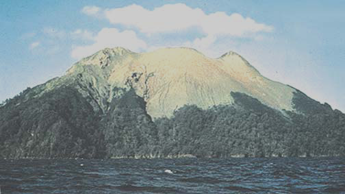
English: Bam Island, easternmost of Schouten Islands (Le Maire Islands), Papua New Guinea, off north coast minus 40 percent brightness processed |
| Datum | not stated |
| Bron | http://msi.nga.mil/MSISiteContent/StaticFiles/NAV_PUBS/SD/Pub164/Pub164bk.pdf, page 208 |
| Auteur | Jack Lockwood, USGS |
Licentie
Deze afbeelding bevindt zich in het publiek domein omdat het materiaal bevat dat oorspronkelijk afkomstig is van de United States Geological Survey, een agentschap van de United States Department of the Interior. Voor meer informatie, zie het officiële USGS-auteursrechtenbeleid
|
Bestandsgeschiedenis
Klik op een datum/tijd om het bestand te zien zoals het destijds was.
| Datum/tijd | Miniatuur | Afmetingen | Gebruiker | Opmerking | |
|---|---|---|---|---|---|
| huidige versie | 23 jun 2012 23:51 | | 504 × 283 (225 kB) | Ratzer | {{Information |Description ={{en|1=Bam Island, easternmost of Schouten Islands (Le Maire Islands), Papua New Guinea, off north coast}} |Source =http://msi.nga.mil/MSISiteContent/StaticFiles/NAV_PUBS/SD/Pub164/Pub164bk.pdf, page 208 |Author ... |
Bestandsgebruik
Dit bestand wordt op de volgende pagina gebruikt:
Globaal bestandsgebruik
De volgende andere wiki's gebruiken dit bestand:
- Gebruikt op ca.wikipedia.org
- Gebruikt op de.wikipedia.org
- Gebruikt op en.wikipedia.org
- Gebruikt op eu.wikipedia.org
- Gebruikt op pt.wikipedia.org
- Gebruikt op ru.wikipedia.org
- Gebruikt op www.wikidata.org
- Gebruikt op zh.wikipedia.org