
Bestand:BelgianCongoProvinces-1933-60.svg

Afmetingen van deze voorvertoning van het type PNG van dit SVG-bestand: 593 × 599 pixels Andere resoluties: 237 × 240 pixels | 475 × 480 pixels | 760 × 768 pixels | 1.013 × 1.024 pixels | 2.026 × 2.048 pixels | 640 × 647 pixels.
Oorspronkelijk bestand (SVG-bestand, nominaal 640 × 647 pixels, bestandsgrootte: 180 kB)
| Dit is een bestand van Wikimedia Commons. Onderstaande beschrijving komt van de beschrijving van het bestand daar. |
Beschrijving
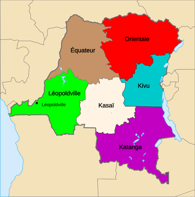
| Beschrijving | Map of the provinces of the Belgian Congo, from 1933 until Independence (1960). |
| Datum | |
| Bron | Eigen werk gebaseerd op: Congo Kinshasa Template.svg van Moyogo |
| Auteur | Themightyquill |
| SVG ontwikkeling | De broncode van dit SVG-bestand is deugdelijk. |
Licentie
Dit bestand is gelicenseerd onder de Creative Commons-licentie Naamsvermelding-Gelijk delen 3.0 Unported
- De gebruiker mag:
- Delen – het werk kopiëren, verspreiden en doorgeven
- Remixen – afgeleide werken maken
- Onder de volgende voorwaarden:
- naamsvermelding – U moet op een gepaste manier aan naamsvermelding doen, een link naar de licentie geven, en aangeven of er wijzigingen in het werk zijn aangebracht. U mag dit op elke redelijke manier doen, maar niet zodanig dat de indruk wordt gewekt dat de licentiegever instemt met uw werk of uw gebruik van zijn werk.
- Gelijk delen – Als u het werk heeft geremixt, veranderd, of erop heeft voortgebouwd, moet u het gewijzigde materiaal verspreiden onder dezelfde licentie als het oorspronkelijke werk, of een daarmee compatibele licentie.
Oorspronkelijk uploadlogboek
This image is a derivative work of the following images:
- Congo CrisisMap.png licensed with Cc-by-sa-3.0-migrated-with-disclaimers, GFDL-en
- 2010-08-10T13:57:01Z Beao 440x404 (11149 Bytes) Transparent.
- 2006-10-09T17:13:25Z Kelovy 440x404 (10193 Bytes) == Opis súboru == Map of Territorial Control during the Congo Crisis (1960-61). Color Key *'''Yellow''': National Government based in Léopoldville *'''Red''': Rival National Government based in Stanleyville *'''Green''':
- Congo Kinshasa Template.svg licensed with Cc-by-sa-2.5,2.0,1.0, Cc-by-sa-3.0-migrated, GFDL
- 2006-07-13T08:49:51Z Moyogo 640x647 (270716 Bytes) Lualaba province is Lualaba district + Kolwezi-city district
- 2006-05-28T19:43:22Z Moyogo 640x647 (268950 Bytes) split into layers, added provinces of 1960, 1966 and 1988.
- 2006-05-26T14:57:57Z Moyogo 640x647 (180669 Bytes) improvements to the template: added border of neighbouring countries, provinces' border are uniform, colours drawn from other maps on WP.
- 2005-09-30T10:36:59Z Moyogo 650x650 (117305 Bytes) Template for Province or District maps for the Congo Kinshasa. Each province has an ID in the form Province with the name, e.g. ProvinceKatanga The Provinces are only the outline stroke, no filling Each district has an ID i
Uploaded with derivativeFX
Bestandsgeschiedenis
Klik op een datum/tijd om het bestand te zien zoals het destijds was.
| Datum/tijd | Miniatuur | Afmetingen | Gebruiker | Opmerking | |
|---|---|---|---|---|---|
| huidige versie | 6 dec 2010 03:45 | | 640 × 647 (180 kB) | Themightyquill | {{Information |Description=Map of the provinces of the Belgian Congo, from 1933 until Independence (1960). |Source=*File:Congo_CrisisMap.png *File:Congo_Kinshasa_Template.svg |Date=2010-12-06 01:20 (UTC) |Author=*File:Congo_CrisisMap.png |
Bestandsgebruik
Dit bestand wordt op de volgende 2 pagina's gebruikt:
Globaal bestandsgebruik
De volgende andere wiki's gebruiken dit bestand:
- Gebruikt op de.wikipedia.org
- Gebruikt op en.wikipedia.org
- Gebruikt op fr.wikipedia.org
- Gebruikt op ja.wikipedia.org
- Gebruikt op sk.wikipedia.org
- Gebruikt op zh.wikipedia.org