
Bestand:Belgian Railway Line 51.png
Grootte van deze voorvertoning: 800 × 570 pixels. Andere resoluties: 320 × 228 pixels | 640 × 456 pixels | 1.024 × 730 pixels | 1.280 × 912 pixels | 1.471 × 1.048 pixels.
Oorspronkelijk bestand (1.471 × 1.048 pixels, bestandsgrootte: 1,29 MB, MIME-type: image/png)
| Dit is een bestand van Wikimedia Commons. Onderstaande beschrijving komt van de beschrijving van het bestand daar. |
Beschrijving
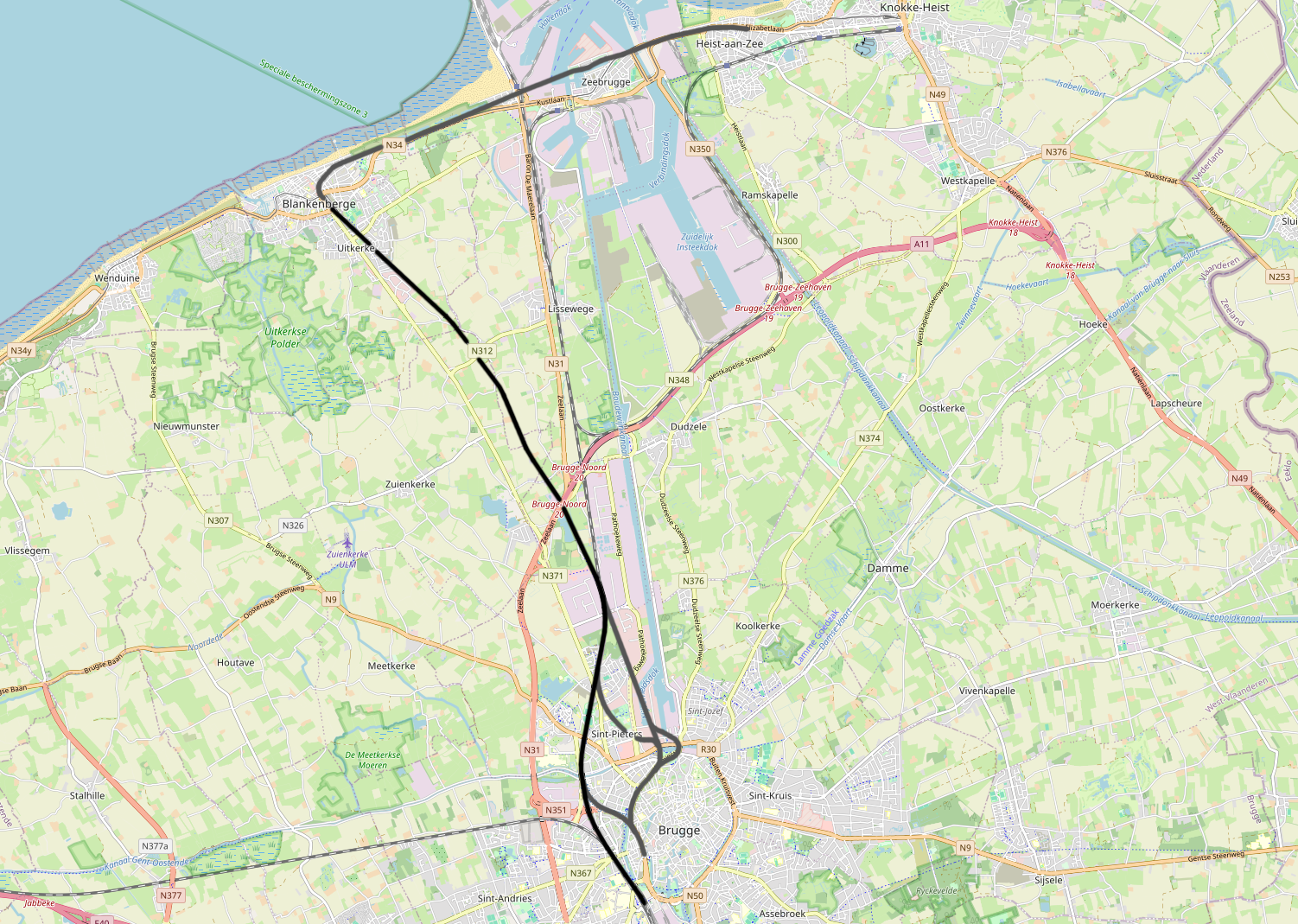
| Beschrijving | Belgian Railway Line 51, Brugge - Blankenberge (Heist) |
| Datum | |
| Bron | openstreetmap.org. |
| Auteur | OpenStreetMap contributors |
| Toestemming (Hergebruik van dit bestand) |
All OpenStreetMap data and maps are Creative Commons "CC-BY-SA 2.0" licensed |
Licentie
Dit bestand is gelicenseerd onder de Creative Commons-licentie Naamsvermelding-Gelijk delen 2.0 Unported
- De gebruiker mag:
- Delen – het werk kopiëren, verspreiden en doorgeven
- Remixen – afgeleide werken maken
- Onder de volgende voorwaarden:
- naamsvermelding – U moet op een gepaste manier aan naamsvermelding doen, een link naar de licentie geven, en aangeven of er wijzigingen in het werk zijn aangebracht. U mag dit op elke redelijke manier doen, maar niet zodanig dat de indruk wordt gewekt dat de licentiegever instemt met uw werk of uw gebruik van zijn werk.
- Gelijk delen – Als u het werk heeft geremixt, veranderd, of erop heeft voortgebouwd, moet u het gewijzigde materiaal verspreiden onder dezelfde licentie als het oorspronkelijke werk, of een daarmee compatibele licentie.
Bestandsgeschiedenis
Klik op een datum/tijd om het bestand te zien zoals het destijds was.
| Datum/tijd | Miniatuur | Afmetingen | Gebruiker | Opmerking | |
|---|---|---|---|---|---|
| huidige versie | 5 mei 2016 21:40 | | 1.471 × 1.048 (1,29 MB) | Vunz | improved |
| 5 apr 2011 00:30 |  | 1.129 × 810 (610 kB) | Vunz | Open Street Map | |
| 21 jan 2009 23:15 |  | 520 × 390 (18 kB) | Vunz | {{Information |Description={{nl|1=spoormap lijn 51}} |Source=eigen werk (own work) |Author=Wiebevl |Date=21/01/2009 |Permission= |other_versions= }} <!--{{ImageUpload|full}}--> Category:Public domain maps from demis.nl [[Category:Rai |
Bestandsgebruik
Dit bestand wordt op de volgende pagina gebruikt:
Globaal bestandsgebruik
De volgende andere wiki's gebruiken dit bestand:
- Gebruikt op fr.wikipedia.org
- Gebruikt op vls.wikipedia.org
- Gebruikt op www.wikidata.org