
Bestand:Cairngorms National Park UK location map.svg

Afmetingen van deze voorvertoning van het type PNG van dit SVG-bestand: 728 × 599 pixels Andere resoluties: 292 × 240 pixels | 583 × 480 pixels | 933 × 768 pixels | 1.244 × 1.024 pixels | 2.488 × 2.048 pixels | 1.425 × 1.173 pixels.
Oorspronkelijk bestand (SVG-bestand, nominaal 1.425 × 1.173 pixels, bestandsgrootte: 1,35 MB)
| Dit is een bestand van Wikimedia Commons. Onderstaande beschrijving komt van de beschrijving van het bestand daar. |
| Beschrijving |
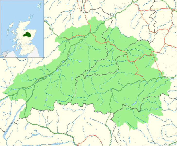
Map of the Cairngorms National Park, UK with the following information shown:
Equirectangular map projection on WGS 84 datum, with N/S stretched 180% Geographic limits:
|
| Datum | |
| Bron |
Office of National Statistics Geography
|
| Auteur | Nilfanion, created using Ordnance Survey data |
| Toestemming (Hergebruik van dit bestand) |
Dit bestand is gelicenseerd onder de Creative Commons-licentie Naamsvermelding-Gelijk delen 3.0 Unported Naamsvermelding: Contains Ordnance Survey data © Crown copyright and database right
|
Bestandsgeschiedenis
Klik op een datum/tijd om het bestand te zien zoals het destijds was.
| Datum/tijd | Miniatuur | Afmetingen | Gebruiker | Opmerking | |
|---|---|---|---|---|---|
| huidige versie | 29 okt 2010 23:46 | | 1.425 × 1.173 (1,35 MB) | Nilfanion | {{Information |Description=Map of the Cairngorms National Park, UK with the following information shown: *National Park boundary *Administrative borders *Coastline, lakes and rivers *Roads and railways *Urban areas Equirect |
Bestandsgebruik
Dit bestand wordt op de volgende pagina gebruikt:
Globaal bestandsgebruik
De volgende andere wiki's gebruiken dit bestand:
- Gebruikt op da.wikipedia.org
- Gebruikt op en.wikipedia.org
- Gebruikt op eu.wikipedia.org
- Gebruikt op fi.wikipedia.org
- Gebruikt op it.wikipedia.org
- Gebruikt op lt.wikipedia.org
- Gebruikt op pnb.wikipedia.org