
Bestand:Carte Topographique de l'Ile Saint Eustache Samuel Fahlberg 1830.jpg
Oorspronkelijk bestand (5.458 × 4.540 pixels, bestandsgrootte: 18,71 MB, MIME-type: image/jpeg)
| Dit is een bestand van Wikimedia Commons. Onderstaande beschrijving komt van de beschrijving van het bestand daar. |
Beschrijving
| Beschrijving |
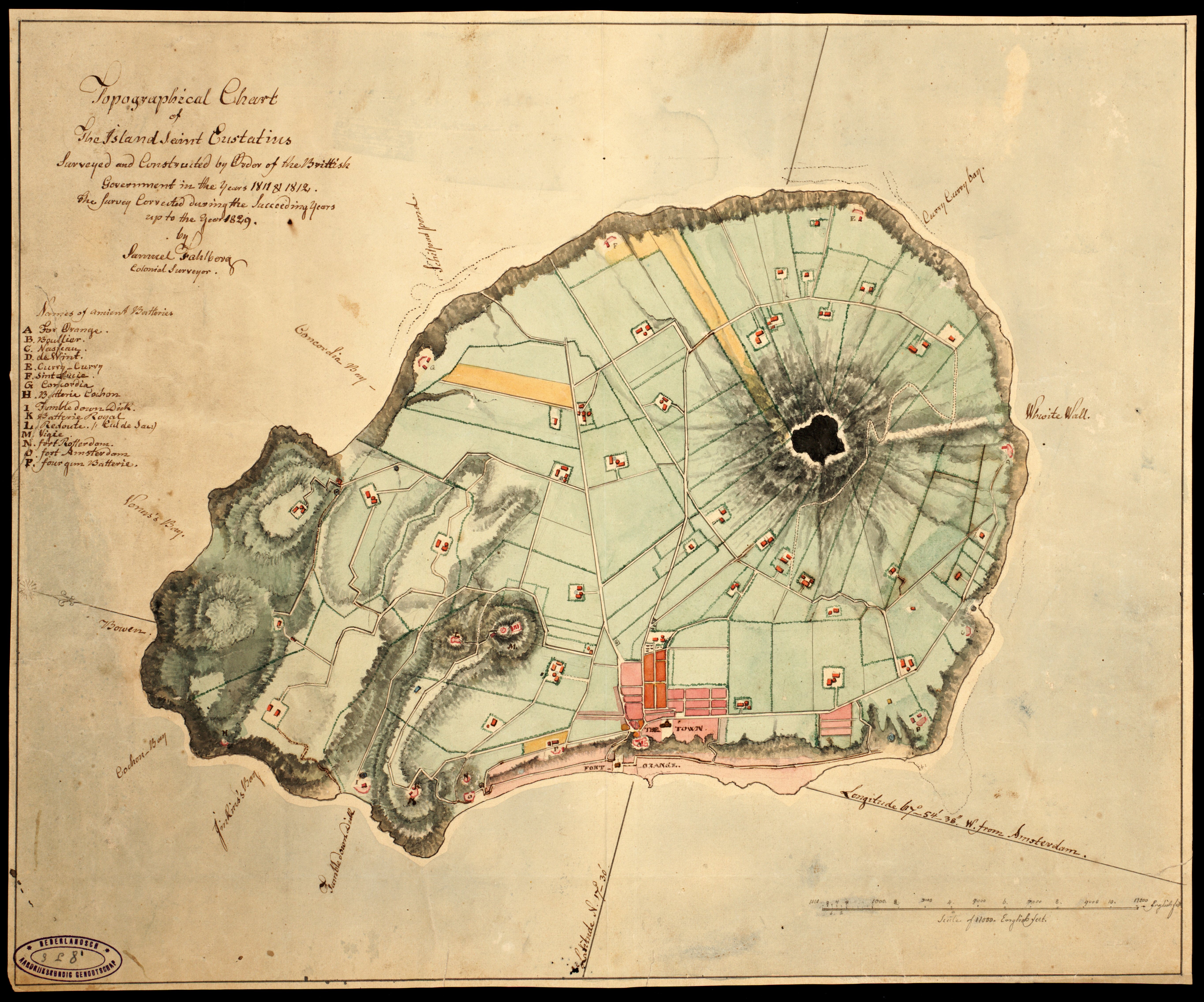
English: Topographic Map of the Island Sint Eustatius Dutch Caribbean by Samuel Fahlberg (Sweden 1758 - Sint Eustatius 1834) in 1830. Name of the map: Carte Topographique de l'Ille Saint Eustache Relevée & Corrigée par Samuel Fahlberg 1830. Language French |
| Datum | |
| Bron | https://hdl.handle.net/11245/3.24 |
| Auteur | Samuel Fahlberg |
Licentie
|
Het tweedimensionale kunstwerk afgebeeld op deze afbeelding valt in het publiek domein omdat:
Reproducties van het werk kunnen ook worden beschouwd als publiek domein omdat ze geen oorspronkelijk karakter hebben. Dit geldt voor reproducties gemaakt in de Verenigde Staten (zie Bridgeman Art Library v. Corel Corp.), Duitsland en veel andere landen.
| ||||
Bestandsgeschiedenis
Klik op een datum/tijd om het bestand te zien zoals het destijds was.
| Datum/tijd | Miniatuur | Afmetingen | Gebruiker | Opmerking | |
|---|---|---|---|---|---|
| huidige versie | 10 jan 2022 11:52 | | 5.458 × 4.540 (18,71 MB) | Carib93 | Official record |
| 10 jan 2022 08:57 |  | 4.583 × 3.255 (3,39 MB) | Carib93 | Uploaded a work by Samuel Fahlberg from https://www.statiagovernment.com/binaries/content/gallery/sint-eustatius-en/content-afbeeldingen/images-for-slideshow/history/old-maps/fahlberg-1830.jpg?download with UploadWizard |
Bestandsgebruik
Dit bestand wordt op de volgende 2 pagina's gebruikt:
Globaal bestandsgebruik
De volgende andere wiki's gebruiken dit bestand:
- Gebruikt op www.wikidata.org