
Bestand:French Empire in September 1812.png
Grootte van deze voorvertoning: 592 × 600 pixels. Andere resoluties: 237 × 240 pixels | 474 × 480 pixels | 758 × 768 pixels | 1.011 × 1.024 pixels | 1.895 × 1.920 pixels.
Oorspronkelijk bestand (1.895 × 1.920 pixels, bestandsgrootte: 646 kB, MIME-type: image/png)
| Dit is een bestand van Wikimedia Commons. Onderstaande beschrijving komt van de beschrijving van het bestand daar. |
Beschrijving
| Beschrijving |
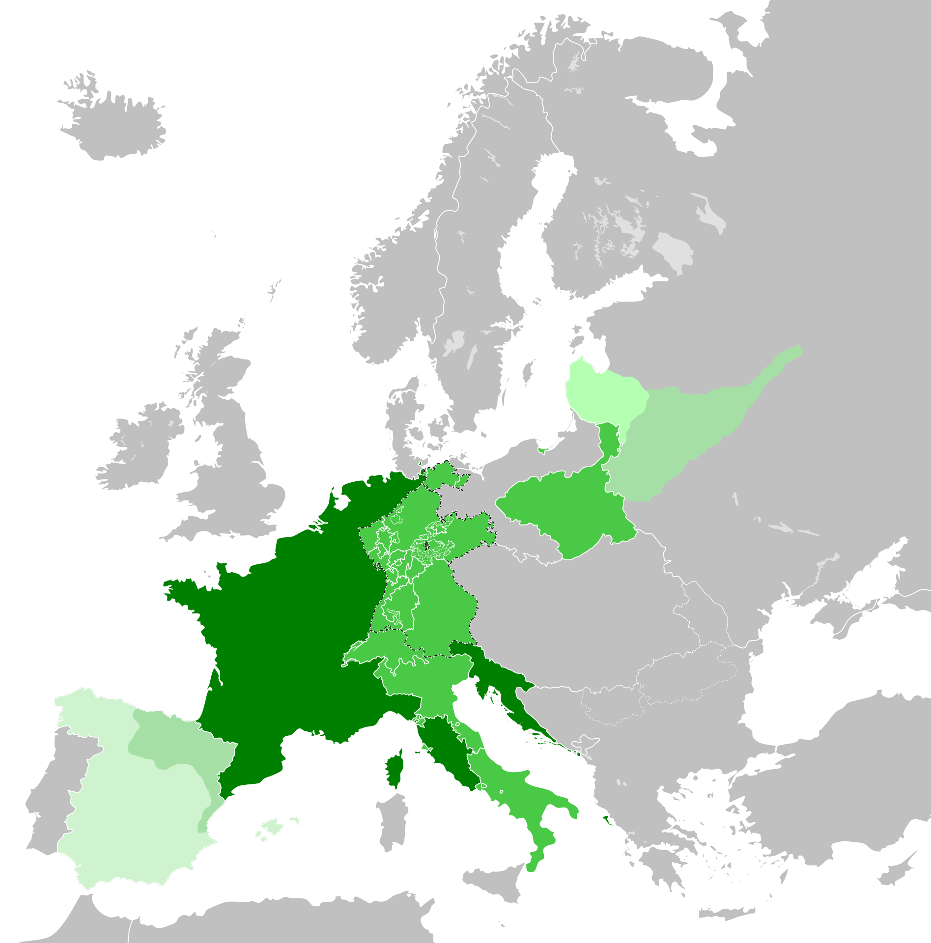
English: The original map is by alpathon. I have edited this to include the French invasion of Russia. This work depicts France at its peak territorial control |
| Datum | |
| Bron | This is originally Alpathon’s map. I have edited the map to make it accurate for the period |
| Auteur | Alpathon |
Licentie
Dit bestand is gelicenseerd onder de Creative Commons Naamsvermelding 4.0 Internationaal licentie.
- De gebruiker mag:
- Delen – het werk kopiëren, verspreiden en doorgeven
- Remixen – afgeleide werken maken
- Onder de volgende voorwaarden:
- naamsvermelding – U moet op een gepaste manier aan naamsvermelding doen, een link naar de licentie geven, en aangeven of er wijzigingen in het werk zijn aangebracht. U mag dit op elke redelijke manier doen, maar niet zodanig dat de indruk wordt gewekt dat de licentiegever instemt met uw werk of uw gebruik van zijn werk.
Bestandsgeschiedenis
Klik op een datum/tijd om het bestand te zien zoals het destijds was.
| Datum/tijd | Miniatuur | Afmetingen | Gebruiker | Opmerking | |
|---|---|---|---|---|---|
| huidige versie | 23 jul 2023 06:08 | | 1.895 × 1.920 (646 kB) | Ihaveabadname | Accuracy |
| 2 jun 2023 10:52 |  | 1.895 × 1.920 (641 kB) | The Great Mule of Eupatoria | Uploaded a work by Alpathon from This is originally Alpathon’s map. I have edited the map to make it accurate for the period with UploadWizard |
Bestandsgebruik
Dit bestand wordt op de volgende pagina gebruikt: