
Bestand:GreatDismalSwampMap.jpg
Grootte van deze voorvertoning: 468 × 600 pixels. Andere resoluties: 187 × 240 pixels | 374 × 480 pixels | 599 × 768 pixels | 799 × 1.024 pixels | 2.526 × 3.238 pixels.
Oorspronkelijk bestand (2.526 × 3.238 pixels, bestandsgrootte: 3,64 MB, MIME-type: image/jpeg)
| Dit is een bestand van Wikimedia Commons. Onderstaande beschrijving komt van de beschrijving van het bestand daar. |
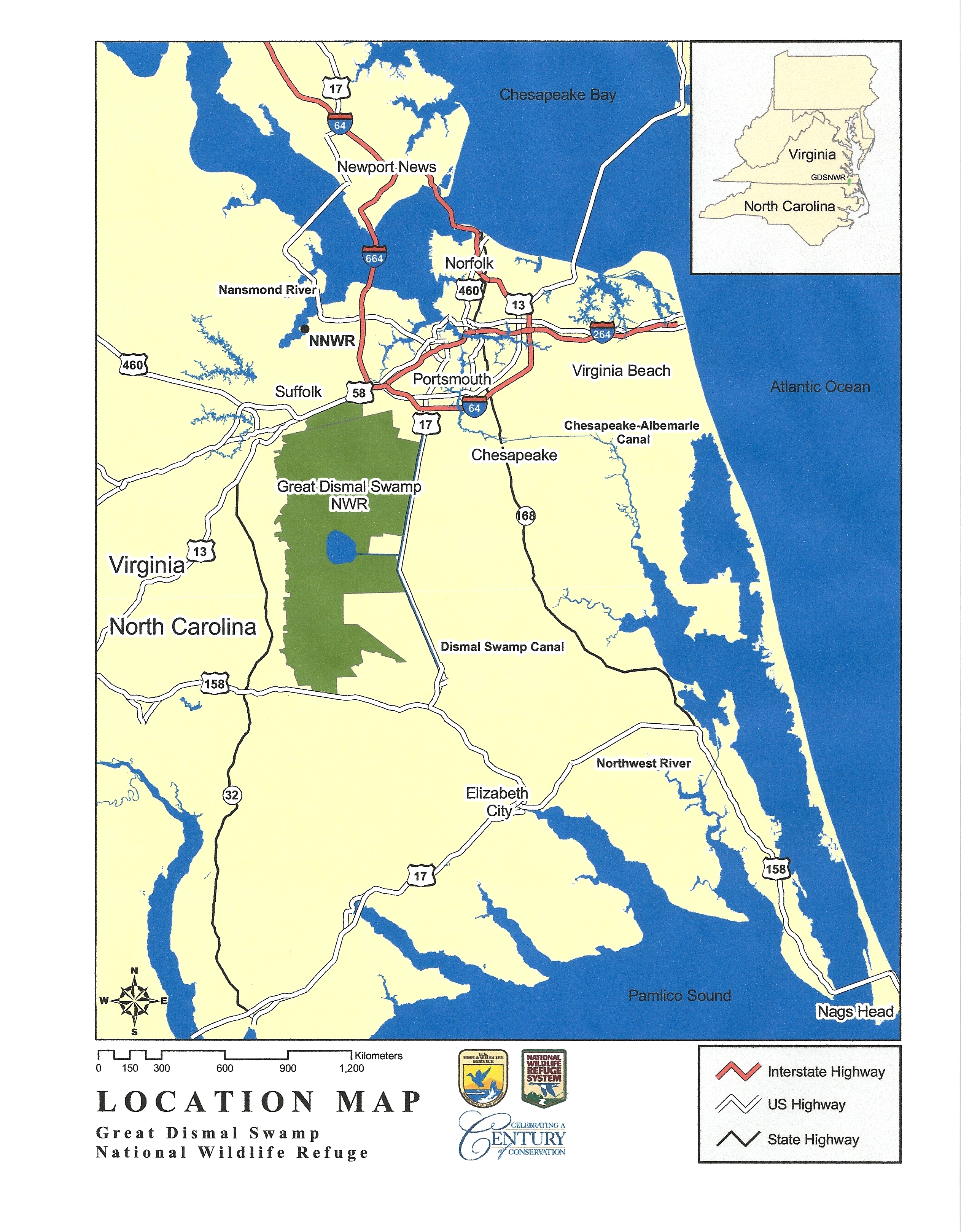
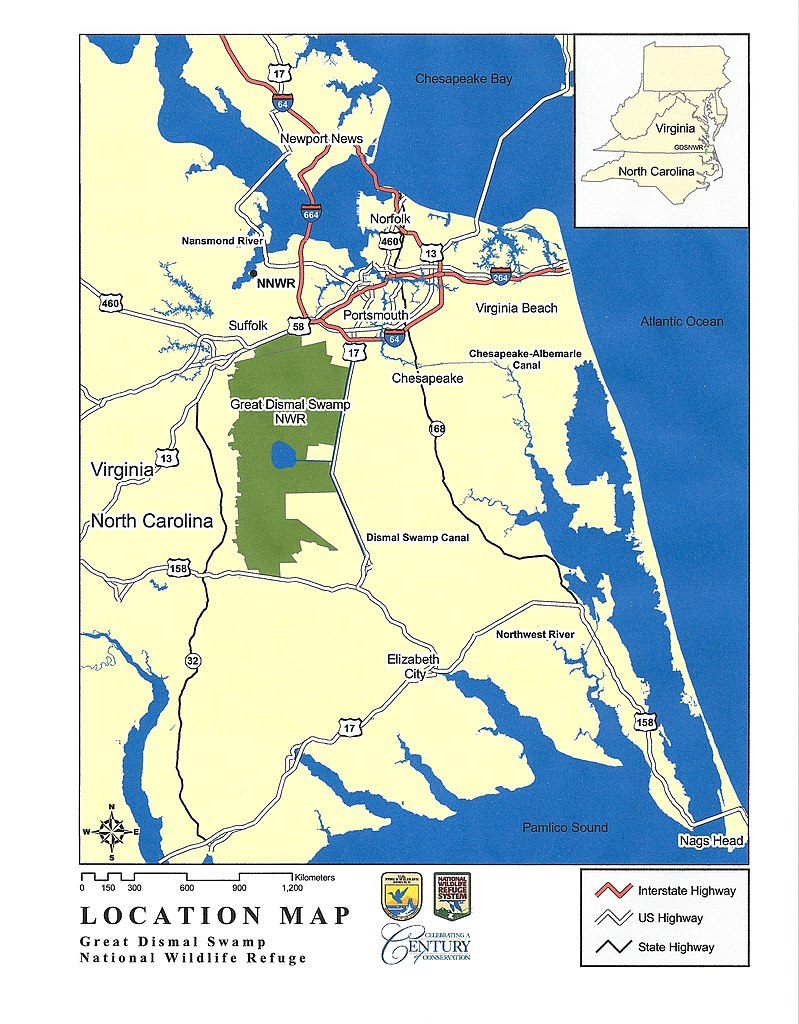
| Beschrijving | Map of the Great Dismal Swamp, in Virginia and North Carolina, USA | |||
| Datum | Datum onbekend | |||
| Bron | US Fish and Wildlife Service - http://www.fws.gov/northeast/greatdismalswamp/pdf/LocationMap8by11.pdf | |||
| Auteur | US Fish and Wildlife Service | |||
| Toestemming (Hergebruik van dit bestand) |
|
|||
| Andere versies |

.jpg)

|
Deze kaartafbeelding zou opnieuw moeten worden aangemaakt als een SVG-bestand door vectorafbeeldingen te gebruiken. Dit heeft een aantal voordelen; zie Commons:Media for cleanup voor meer informatie. Als er een SVG-formaat van deze afbeelding bestaat, dan deze graag uploaden. Nadat u dit heeft gedaan, gelieve dit sjabloon te vervangen door het sjabloon {{vector version available|nieuwe bestandsnaam.svg}} op deze afbeeldingspagina.
|


Bestandsgeschiedenis
Klik op een datum/tijd om het bestand te zien zoals het destijds was.
| Datum/tijd | Miniatuur | Afmetingen | Gebruiker | Opmerking | |
|---|---|---|---|---|---|
| huidige versie | 13 mrt 2023 02:22 | | 2.526 × 3.238 (3,64 MB) | Smasongarrison | Cropped 7 % vertically using CropTool with lossless mode. |
| 19 aug 2011 00:15 |  | 2.526 × 3.484 (3,25 MB) | PumpkinSky | {{Information |Description=Map of the Great Dismal Swamp, in Virginia and North Carolina, USA |Source=US Fish and Wildlife Service - http://www.fws.gov/northeast/greatdismalswamp/pdf/LocationMap8by11.pdf |Date= unknown |Author=US Fish and Wildlife Service |
Bestandsgebruik
Dit bestand wordt op de volgende pagina gebruikt:
Globaal bestandsgebruik
De volgende andere wiki's gebruiken dit bestand:
- Gebruikt op en.wikipedia.org