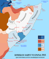
Bestand:Horn1915ad fin.png
Uiterlijk
Horn1915ad_fin.png (500 × 599 pixels, bestandsgrootte: 179 kB, MIME-type: image/png)
Bestandsgeschiedenis
Klik op een datum/tijd om het bestand te zien zoals het destijds was.
| Datum/tijd | Miniatuur | Afmetingen | Gebruiker | Opmerking | |
|---|---|---|---|---|---|
| huidige versie | 17 jun 2020 01:56 |  | 500 × 599 (179 kB) | Althair | Mistake-Reverted to version as of 17:48, 3 June 2020 (UTC) |
| 17 jun 2020 01:54 |  | 1.110 × 1.327 (166 kB) | Althair | Not png-Reverted to version as of 00:49, 7 February 2017 (UTC) | |
| 3 jun 2020 19:48 |  | 500 × 599 (179 kB) | RicherThrowriith | rest | |
| 3 jun 2020 14:26 |  | 500 × 599 (180 kB) | RicherThrowriith | kings african rifles report | |
| 30 mei 2020 16:02 |  | 500 × 599 (179 kB) | RicherThrowriith | clearer sighting | |
| 30 mei 2020 01:27 |  | 500 × 599 (180 kB) | RicherThrowriith | incorporated the 1915 borders according to the memoirs of general ismay, page 28 (see description box) | |
| 7 feb 2017 02:49 |  | 1.110 × 1.327 (166 kB) | De728631 | RANSKA should have had white letters | |
| 7 feb 2017 02:47 |  | 1.110 × 1.327 (166 kB) | De728631 | different hues to assist the colour blind | |
| 31 jul 2008 17:05 |  | 1.110 × 1.327 (237 kB) | Hapo | == Summary == {{Information |Description=''fi'': Afrikan sarvi vuonna 1915 ajan historiallisten asiakirjojen mukaan<br />''en'': Horn of Africa, c. 1915 C.E. |Source=Finnish Wikipedia. Finnish Translation of Horn1915ad.png. |Date |
Bestandsgebruik
Dit bestand wordt op de volgende 2 pagina's gebruikt:
Globaal bestandsgebruik
De volgende andere wiki's gebruiken dit bestand:
- Gebruikt op ar.wikipedia.org
- Gebruikt op arz.wikipedia.org
- Gebruikt op da.wikipedia.org
- Gebruikt op de.wikipedia.org
- Gebruikt op en.wiktionary.org
- Gebruikt op fi.wikipedia.org
- Gebruikt op fr.wikipedia.org
- Gebruikt op it.wikipedia.org
- Gebruikt op ja.wikipedia.org
- Gebruikt op ru.wikipedia.org
- Gebruikt op uk.wikipedia.org

