
Bestand:Indonesia the Netherlands Locator.svg

Afmetingen van deze voorvertoning van het type PNG van dit SVG-bestand: 800 × 353 pixels Andere resoluties: 320 × 141 pixels | 640 × 283 pixels | 1.024 × 452 pixels | 1.280 × 565 pixels | 2.560 × 1.130 pixels | 940 × 415 pixels.
Oorspronkelijk bestand (SVG-bestand, nominaal 940 × 415 pixels, bestandsgrootte: 1,7 MB)
| Dit is een bestand van Wikimedia Commons. Onderstaande beschrijving komt van de beschrijving van het bestand daar. |
| Beschrijving |
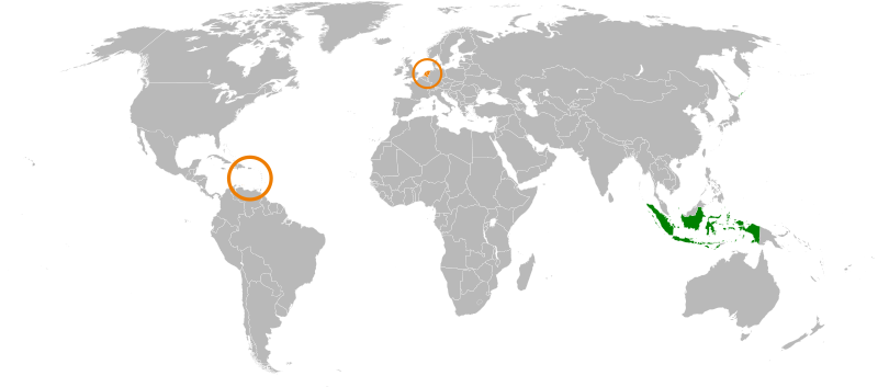
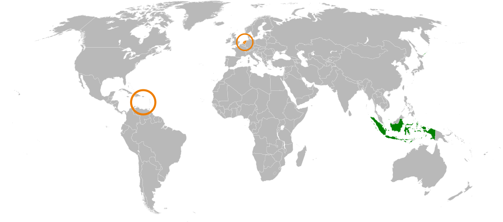
English: Japan, the Netherlands locator map. |
| Datum | (UTC) |
| Bron | |
| Auteur |
|
| Dit is een geretoucheerde foto, wat betekent dat de originele versie digitaal aangepast is. Aanpassingen: Decoloured Japan, coloured Indonesia. Het origineel kan hier bekeken worden: Japan the Netherlands Locator.svg.
|
Ik, de auteursrechthebbende van dit werk, maak het hierbij onder de volgende licentie beschikbaar:
| Ik, de auteursrechthebbende van dit werk, geef dit werk vrij in het publieke domein. Dit is wereldwijd van toepassing. In sommige landen is dit wettelijk niet mogelijk; in die gevallen geldt: Ik sta iedereen toe dit werk voor eender welk doel te gebruiken, zonder enige voorwaarden, tenzij zulke voorwaarden door de wet worden voorgeschreven. |
Oorspronkelijk uploadlogboek
This image is a derivative work of the following images:
- File:Japan_the_Netherlands_Locator.svg licensed with PD-self
- 2009-08-29T09:41:19Z SelfQ 940x415 (1773972 Bytes) {{Information |Description={{en|1=Japan, the Netherlands locator map. }} |Source=Own work by uploader |Author=[[User:SelfQ|SelfQ]] |Date=29 Aug 2009 |Permission= |other_versions=[[File:Japan the Netherlands Locator.png|thumb|
Uploaded with derivativeFX
Bestandsgeschiedenis
Klik op een datum/tijd om het bestand te zien zoals het destijds was.
| Datum/tijd | Miniatuur | Afmetingen | Gebruiker | Opmerking | |
|---|---|---|---|---|---|
| huidige versie | 19 jul 2011 16:28 | | 940 × 415 (1,7 MB) | SudlonrA | Reverted to version as of 19:13, 2 December 2010. Mali somehow became an island. |
| 1 jan 2011 20:38 |  | 940 × 415 (1,18 MB) | Jkwchui | Removed Dutch Antillies from the map. | |
| 2 dec 2010 21:13 |  | 940 × 415 (1,7 MB) | Ciaurlec | {{Information |Description={{en|1=Japan, the Netherlands locator map. }} |Source=*File:Japan_the_Netherlands_Locator.svg |Date=2010-12-02 19:11 (UTC) |Author=*File:Japan_the_Netherlands_Locator.svg: SelfQ *derivative work: ~~~ | |
Bestandsgebruik
Dit bestand wordt op de volgende pagina gebruikt:
Globaal bestandsgebruik
De volgende andere wiki's gebruiken dit bestand:
- Gebruikt op ar.wikipedia.org
- Gebruikt op en.wikipedia.org
- Gebruikt op es.wikipedia.org
- Gebruikt op fr.wikipedia.org
- Gebruikt op he.wikipedia.org
- Gebruikt op id.wikipedia.org
- Gebruikt op ru.wikipedia.org
- Gebruikt op www.wikidata.org
- Gebruikt op zh.wikipedia.org