
Bestand:Jammu and Kashmir in 1946 map of India by National Geographic.jpg

Grootte van deze voorvertoning: 769 × 599 pixels. Andere resoluties: 308 × 240 pixels | 616 × 480 pixels | 985 × 768 pixels | 1.280 × 998 pixels | 1.551 × 1.209 pixels.
Oorspronkelijk bestand (1.551 × 1.209 pixels, bestandsgrootte: 429 kB, MIME-type: image/jpeg)
| Dit is een bestand van Wikimedia Commons. Onderstaande beschrijving komt van de beschrijving van het bestand daar. |
Beschrijving
| Beschrijving |
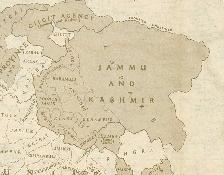
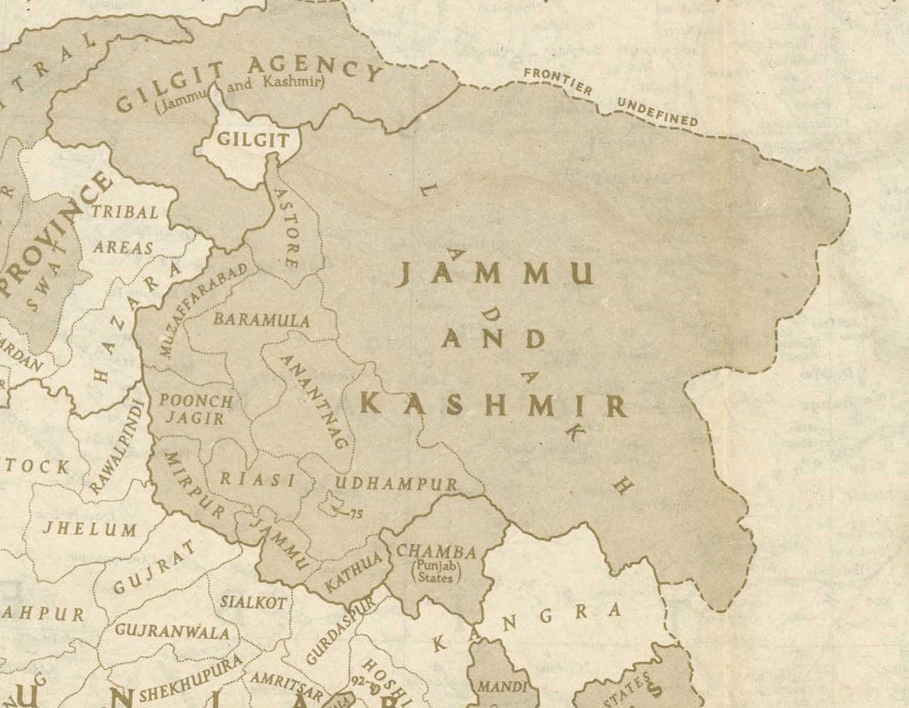
English: This is one of the last few maps of Jammu and Kashmir produced during the British Raj, just before the independence of India and Pakistan |
| Datum | |
| Bron | http://pahar.in/wpfb-file/1946-political-subdivisions-of-india-by-national-geographic-jpg/ |
| Auteur | National Geographic |
| Andere versies |

Licentie
This media file is in the public domain in the United States. This applies to U.S. works where the copyright has expired, often because its first publication occurred prior to January 1, {{{year}}}, and if not then due to lack of notice or renewal. See this page for further explanation.
|
 | |
 |
This image might not be in the public domain outside of the United States; this especially applies in the countries and areas that do not apply the rule of the shorter term for US works, such as Canada, Mainland China (not Hong Kong or Macao), Germany, Mexico, and Switzerland. The creator and year of publication are essential information and must be provided. See Wikipedia:Public domain and Wikipedia:Copyrights for more details.
|
Bestandsgeschiedenis
Klik op een datum/tijd om het bestand te zien zoals het destijds was.
| Datum/tijd | Miniatuur | Afmetingen | Gebruiker | Opmerking | |
|---|---|---|---|---|---|
| huidige versie | 21 okt 2020 22:48 | | 1.551 × 1.209 (429 kB) | Kautilya3 | Uploaded a work by National Geographic from http://pahar.in/wpfb-file/1946-political-subdivisions-of-india-by-national-geographic-jpg/ with UploadWizard |
Bestandsgebruik
Dit bestand wordt op de volgende pagina gebruikt:
Globaal bestandsgebruik
De volgende andere wiki's gebruiken dit bestand:
- Gebruikt op bn.wikipedia.org
- Gebruikt op en.wikipedia.org
- Azad Kashmir
- Gilgit Agency
- History of Poonch District
- Talk:Sino-Indian border dispute
- Gilgit-Baltistan
- Elections in Jammu and Kashmir
- Ardagh–Johnson Line
- 1947 Jammu massacres
- Template:User J&K princely state
- Wikipedia:Userboxes/Location/Kashmir
- Forward policy (Sino-Indian conflict)
- 1837 Poonch Revolt
- 1947 Gilgit rebellion
- User:Falcaorib/India and Pakistan
- Gebruikt op en.wikivoyage.org
- Gebruikt op hi.wikipedia.org
- Gebruikt op ko.wikipedia.org
- Gebruikt op zh.wikipedia.org