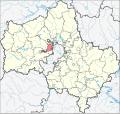
Bestand:Location of Krasnogorsk Region (Moscow Oblast).svg

Pagina-inhoud wordt niet ondersteund in andere talen.
Uit Wikipedia, de vrije encyclopedie

Oorspronkelijk bestand(SVG-bestand, nominaal 631 × 595 pixels, bestandsgrootte: 1,14 MB)


Beschrijving
English: Image to indicate Moscow Oblast districts. Subject as indicated by filename.
Datum (UTC)
Bron
Auteur


Dit is een geretoucheerde foto, wat betekent dat de originele versie digitaal aangepast is. Het origineel kan hier bekeken worden: Russia Moscow oblast locator map.svg.

Ik, de auteursrechthebbende van dit werk, maak het hierbij onder de volgende licentie beschikbaar:
Public domain Ik, de auteursrechthebbende van dit werk, geef dit werk vrij in het publieke domein. Dit is wereldwijd van toepassing.
In sommige landen is dit wettelijk niet mogelijk; in die gevallen geldt:
Ik sta iedereen toe dit werk voor eender welk doel te gebruiken, zonder enige voorwaarden, tenzij zulke voorwaarden door de wet worden voorgeschreven.

Oorspronkelijk uploadlogboek

This image is a derivative work of the following images:

  • File:Russia_Moscow_oblast_locator_map.svg licensed with PD-self
    • 2009-05-15T09:15:53Z Bogomolov.PL 2522x2385 (85328 Bytes) Black oblast boundaries, softer colors
    • 2009-04-16T13:57:59Z Bogomolov.PL 2522x2385 (75408 Bytes) Vlasikha and Zvyozdny Gorodok added, Zhukovsky territory expanded
    • 2008-07-10T15:02:21Z Bogomolov.PL 1176x1110 (214945 Bytes) {{Information |Description= |Source= |Date= |Author= |Permission= |other_versions= }}
    • 2008-07-10T11:56:04Z Bogomolov.PL 1166x1100 (214589 Bytes) {{Information |Description= |Source= |Date= |Author= |Permission= |other_versions= }}
    • 2008-07-10T08:18:59Z Bogomolov.PL 1166x1100 (214586 Bytes) {{Information |Description= |Source= |Date= |Author= |Permission= |other_versions= }}
    • 2008-07-08T16:03:06Z Bogomolov.PL 1024x966 (211161 Bytes) {{Information |Description= |Source= |Date= |Author= |Permission= |other_versions= }}
    • 2008-07-08T15:41:42Z Bogomolov.PL 1024x966 (207452 Bytes) {{Information |Description= |Source= |Date= |Author= |Permission= |other_versions= }}
    • 2008-06-24T10:12:26Z Bogomolov.PL 588x555 (185658 Bytes) {{Information |Description={{en|1=Russia_Moscow_oblast_locator_map with simplified boundaries}} {{ru|1=Позиционная карта Московской области с упрощенными границами}} |Sour

Bijschriften

Beschrijf in één regel wat dit bestand voorstelt

Items getoond in dit bestand

beeldt af

Bestandsgeschiedenis

Klik op een datum/tijd om het bestand te zien zoals het destijds was.

Datum/tijdMiniatuurAfmetingenGebruikerOpmerking
huidige versie4 okt 2014 13:28Miniatuurafbeelding voor de versie van 4 okt 2014 13:28631 × 595 (1,14 MB)Новикby analogy with other Moscow Oblast districts
5 okt 2013 14:44Miniatuurafbeelding voor de versie van 5 okt 2013 14:442.522 × 2.385 (93 kB)MURRenewed from updated Moscow region map.
9 feb 2010 18:31Miniatuurafbeelding voor de versie van 9 feb 2010 18:312.522 × 2.385 (97 kB)Виктор В{{Information |Description={{en|1=Image to indicate Moscow Oblast districts. Subject as indicated by filename.}} |Source=*Russia_Moscow_oblast_locator_map.svg |Date=2010-02-08 20:32 (UTC) |Author=*[[:File:Rus

Dit bestand wordt op de volgende pagina gebruikt:

Globaal bestandsgebruik

Metadata