
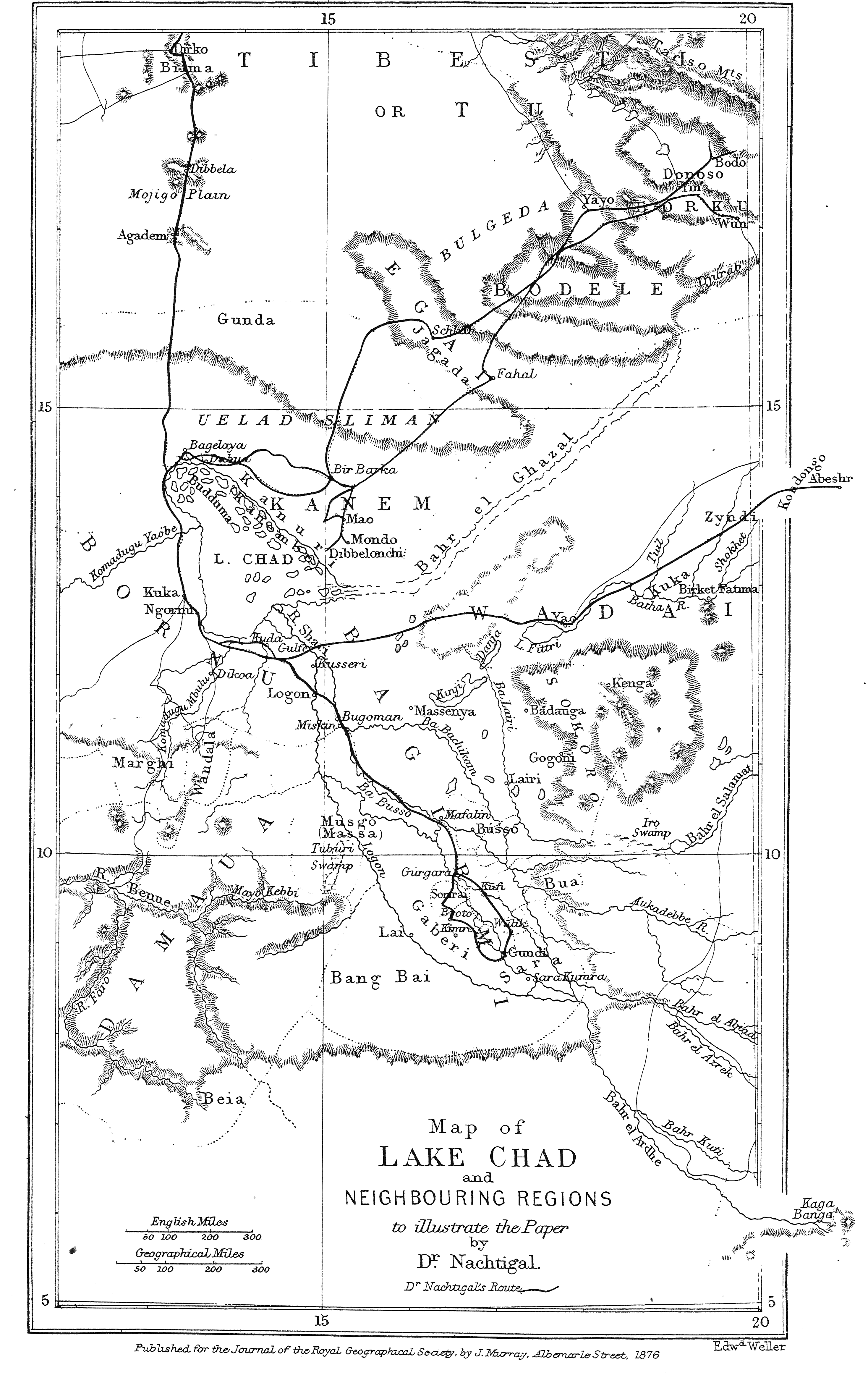
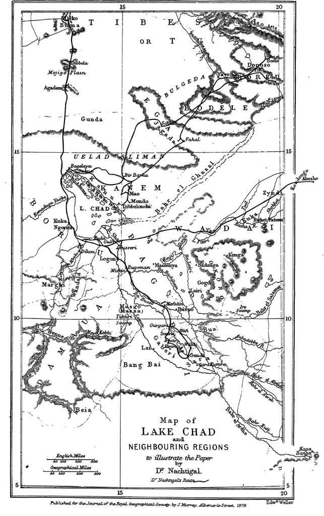
Bestand:Map Lake Chad 1876 B002.png
Grootte van deze voorvertoning: 376 × 599 pixels. Andere resoluties: 150 × 240 pixels | 301 × 480 pixels | 482 × 768 pixels | 643 × 1.024 pixels | 1.285 × 2.048 pixels | 2.936 × 4.677 pixels.
Oorspronkelijk bestand (2.936 × 4.677 pixels, bestandsgrootte: 3 MB, MIME-type: image/png)
| Dit is een bestand van Wikimedia Commons. Onderstaande beschrijving komt van de beschrijving van het bestand daar. |
| Beschrijving |
Oorspronkelijk onderschrift: " Map of Lake Chad and Neighbouring Regions " |
||||
| Datum | voor 1876 | ||||
| Bron | Gustav Nachtigal, Journey to Lake Chad and Neighbouring Regions, In: The Journal of the Royal Geographical Society, vol. 46, 1876, p.396-411 | ||||
| Auteur |
Gustav Nachtigal, Edward Weller, |
||||
| Toestemming (Hergebruik van dit bestand) |
|
||||
Bestandsgeschiedenis
Klik op een datum/tijd om het bestand te zien zoals het destijds was.
| Datum/tijd | Miniatuur | Afmetingen | Gebruiker | Opmerking | |
|---|---|---|---|---|---|
| huidige versie | 5 apr 2016 13:46 | | 2.936 × 4.677 (3 MB) | Katharinaiv | {{Information |Description={{original caption|Map of Lake Chad an neighbouring regions}} |Source=Gustav Nachtigal, ''Journey to lake Chad an Neighbouring Regions", In: ''The Journal of the Royal Geographical Society'', vol. 46, 1876, 396-411 |Date={{ot... |
Bestandsgebruik
Dit bestand wordt op de volgende pagina gebruikt: