
Bestand:Map of March 2012 attacks in Toulouse and Montauban, and scarlet Vigipirate area, in France.svg

Afmetingen van deze voorvertoning van het type PNG van dit SVG-bestand: 632 × 600 pixels Andere resoluties: 253 × 240 pixels | 506 × 480 pixels | 809 × 768 pixels | 1.079 × 1.024 pixels | 2.158 × 2.048 pixels | 2.000 × 1.898 pixels.
Oorspronkelijk bestand (SVG-bestand, nominaal 2.000 × 1.898 pixels, bestandsgrootte: 946 kB)
| Dit is een bestand van Wikimedia Commons. Onderstaande beschrijving komt van de beschrijving van het bestand daar. |
Beschrijving
| Beschrijving |
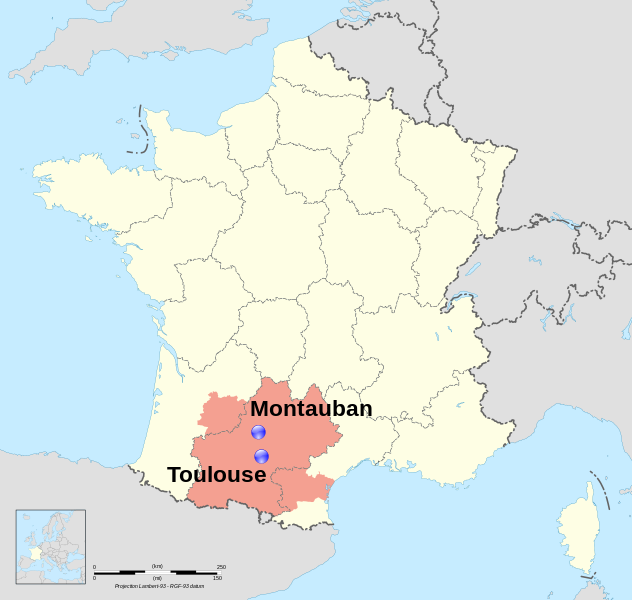
Dansk: Lokalisering af Montauban og Toulouse, to byer i regionen Midi-Pyrénées, Frankrig. I pink, området hvor landets terroralarm, er blevet hævet via Vigipirate. English: Location map of Montauban and Toulouse, two towns in region Midi-Pyrénées, France. In pink, the area covored by the Scarlet Vigipirate level. Français : Carte de localisation de Montauban et Toulouse, deux villes de la région Midi-Pyrénées, France. En rose, la zone couverte par le plan Vigipirate écarlate. |
| Datum | (UTC) |
| Bron |
Dit bestand is afgeleid van: France map Lambert-93 with regions and departments polygons-blank.svg: |
| Auteur | |
| Naamsvermelding (required by the license) | © Sémhur / Wikimedia Commons / |
| SVG ontwikkeling |
Toulouse : region:FR-31 43°36′16″N 1°26′38″E / 43.604482°N 1.443962°E Montauban : region:FR-47 44°01′05″N 1°21′21″E / 44.018056°N 1.355833°E
Licentie
Ik, de auteursrechthebbende van dit werk, maak het hierbij onder de volgende licenties beschikbaar:
This file is licensed under the Creative Commons Attribution-Share Alike Attribution-Share Alike 4.0 International, 3.0 Unported, 2.5 Generic, 2.0 Generic and 1.0 Generic license.
- De gebruiker mag:
- Delen – het werk kopiëren, verspreiden en doorgeven
- Remixen – afgeleide werken maken
- Onder de volgende voorwaarden:
- naamsvermelding – U moet op een gepaste manier aan naamsvermelding doen, een link naar de licentie geven, en aangeven of er wijzigingen in het werk zijn aangebracht. U mag dit op elke redelijke manier doen, maar niet zodanig dat de indruk wordt gewekt dat de licentiegever instemt met uw werk of uw gebruik van zijn werk.
- Gelijk delen – Als u het werk heeft geremixt, veranderd, of erop heeft voortgebouwd, moet u het gewijzigde materiaal verspreiden onder dezelfde licentie als het oorspronkelijke werk, of een daarmee compatibele licentie.
| Copyleft: dit kunstwerk is vrij; u mag het heruitgeven en/of wijzigen in overeenkomst met de voorwaarden van de Free Art-licentie.
U kunt een voorbeeld van de licentie vinden op de website van Copyleft Attitude als ook op andere websites. |
U mag zelf één van de licenties kiezen.
Oorspronkelijk uploadlogboek
This image is a of the following images:
- File:France map Lambert-93 with regions and departments polygons-blank.svg licensed with Cc-by-sa-3.0,2.5,2.0,1.0, GFDL
- 2009-02-03T18:58:47Z Sting 2000x1898 (1873536 Bytes) == Summary == {{Location|46|15|00|N|02|06|00|E|scale:5000000}} {{Information |Description={{en|Blank map of {{W|France}} in the official Lambert-93 projection, with regions and departments as independent polygons. '
Uploaded with derivativeFX
Bestandsgeschiedenis
Klik op een datum/tijd om het bestand te zien zoals het destijds was.
| Datum/tijd | Miniatuur | Afmetingen | Gebruiker | Opmerking | |
|---|---|---|---|---|---|
| huidige versie | 25 mrt 2012 22:32 | | 2.000 × 1.898 (946 kB) | Pic-Sou | deleting boundaries |
| 23 mrt 2012 10:44 |  | 2.000 × 1.898 (1.004 kB) | Sémhur | bigger text ; vigipirate boundaries | |
| 22 mrt 2012 12:10 |  | 2.000 × 1.898 (999 kB) | Sémhur | == {{int:filedesc}} == {{Information |Description={{Multilingual description |en= Location map of en:Montauban and en:Toulouse, two towns in region Midi-Pyrénées, France. |fr= Carte de localisation de fr:Montauban et [[:fr:Toulouse|... |
Bestandsgebruik
Dit bestand wordt op de volgende pagina gebruikt:
Globaal bestandsgebruik
De volgende andere wiki's gebruiken dit bestand:
- Gebruikt op ar.wikipedia.org
- Gebruikt op ca.wikipedia.org
- Gebruikt op cs.wikipedia.org
- Gebruikt op da.wikipedia.org
- Gebruikt op en.wikipedia.org
- Gebruikt op es.wikipedia.org
- Gebruikt op eu.wikipedia.org
- Gebruikt op fa.wikipedia.org
- Gebruikt op fi.wikipedia.org
- Gebruikt op fr.wikipedia.org
- Gebruikt op he.wikipedia.org
- Gebruikt op it.wikipedia.org
- Gebruikt op kk.wikipedia.org
- Gebruikt op nds.wikipedia.org
- Gebruikt op oc.wikipedia.org
- Gebruikt op ro.wikipedia.org
- Gebruikt op ru.wikipedia.org
- Gebruikt op ta.wikipedia.org
- Gebruikt op th.wikipedia.org
- Gebruikt op tr.wikipedia.org
- Gebruikt op uk.wikipedia.org
- Gebruikt op vi.wikipedia.org
- Gebruikt op www.wikidata.org