
Bestand:Mapa-rodovia-anchieta.jpg
Geen hogere resolutie beschikbaar.
Mapa-rodovia-anchieta.jpg (800 × 540 pixels, bestandsgrootte: 105 kB, MIME-type: image/jpeg)
Bestandsgeschiedenis
Klik op een datum/tijd om het bestand te zien zoals het destijds was.
| Datum/tijd | Miniatuur | Afmetingen | Gebruiker | Opmerking | |
|---|---|---|---|---|---|
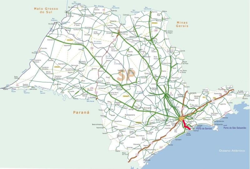
| huidige versie | 28 nov 2008 02:23 | | 800 × 540 (105 kB) | Hector.carvalho | {{Information |Description=Map of Rodovia Anchieta, a highway in the state of São Paulo, Brazil, drawn on a public domain map by the Ministry of Transportation, Brazil. |Source=originally uploaded to :en at en:Image:Mapa-rodovia-anchieta.jpg |Date= |
Bestandsgebruik
Dit bestand wordt op de volgende pagina gebruikt:
Globaal bestandsgebruik
De volgende andere wiki's gebruiken dit bestand:
- Gebruikt op en.wikipedia.org
- Gebruikt op es.wikipedia.org
- Gebruikt op fr.wikipedia.org
- Gebruikt op pt.wikipedia.org
- Gebruikt op uk.wikipedia.org
- Gebruikt op www.wikidata.org