
Bestand:Municipalities North Holland numbers.svg

Afmetingen van deze voorvertoning van het type PNG van dit SVG-bestand: 315 × 599 pixels Andere resoluties: 126 × 240 pixels | 252 × 480 pixels | 404 × 768 pixels | 538 × 1.024 pixels | 1.077 × 2.048 pixels | 363 × 690 pixels.
Oorspronkelijk bestand (SVG-bestand, nominaal 363 × 690 pixels, bestandsgrootte: 125 kB)
| Dit is een bestand van Wikimedia Commons. Onderstaande beschrijving komt van de beschrijving van het bestand daar. |

|
Beschrijving
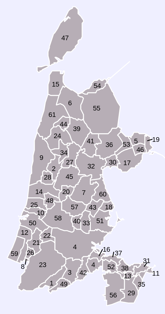
| Beschrijving | Map of municipalities in province of North Holland (NL), numbered |
| Datum | |
| Bron | Own work, based on freely available GIS data |
| Auteur | User:Mtcv |
| Toestemming (Hergebruik van dit bestand) |
Data: attribution required; my work: PD |
Licentie

|
De auteursrechthebbende van dit bestand, Centraal Bureau voor de Statistiek, staat iedereen toe het voor willekeurig welk doel te gebruiken, mits de auteursrechthebbende correct met naam wordt genoemd.
Heruitgave, afgeleide werken, commercieel gebruik en alle andere vormen van gebruik zijn toegestaan. |
Naamsvermelding:
|
| Aantekeningen | Deze afbeelding is aangetekend: Bekijk de aantekeningen op Commons |
Bestandsgeschiedenis
Klik op een datum/tijd om het bestand te zien zoals het destijds was.
| Datum/tijd | Miniatuur | Afmetingen | Gebruiker | Opmerking | |
|---|---|---|---|---|---|
| huidige versie | 8 apr 2008 11:27 | | 363 × 690 (125 kB) | Finavon | border removed |
| 2 jan 2007 15:09 |  | 363 × 690 (125 kB) | Mtcv | new version, 2007 | |
| 2 okt 2006 13:46 |  | 121 × 230 (131 kB) | Mtcv | {{Information| |Description=Map of municipalities in province of North Holland (NL), numbered |Source=Own work, based on freely available GIS data |Date=2006-10-02 |Author=User:Mtcv |Permission=Data: attribution required; my work: PD }} |
Bestandsgebruik
Dit bestand wordt op de volgende 2 pagina's gebruikt:
Globaal bestandsgebruik
De volgende andere wiki's gebruiken dit bestand:
- Gebruikt op ca.wikipedia.org
- Gebruikt op es.wikipedia.org
- Gebruikt op fr.wikipedia.org