
Bestand:Peleliu map.jpg

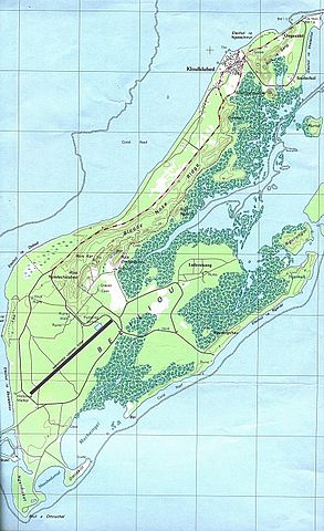
Grootte van deze voorvertoning: 366 × 599 pixels. Andere resoluties: 146 × 240 pixels | 293 × 480 pixels | 850 × 1.392 pixels.
Oorspronkelijk bestand (850 × 1.392 pixels, bestandsgrootte: 505 kB, MIME-type: image/jpeg)
| Dit is een bestand van Wikimedia Commons. Onderstaande beschrijving komt van de beschrijving van het bestand daar. |
Beschrijving
| Beschrijving |
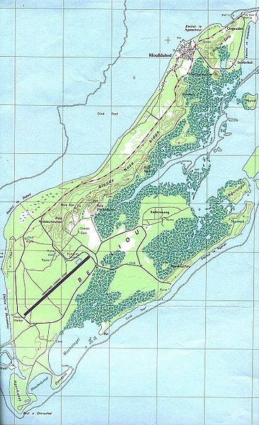
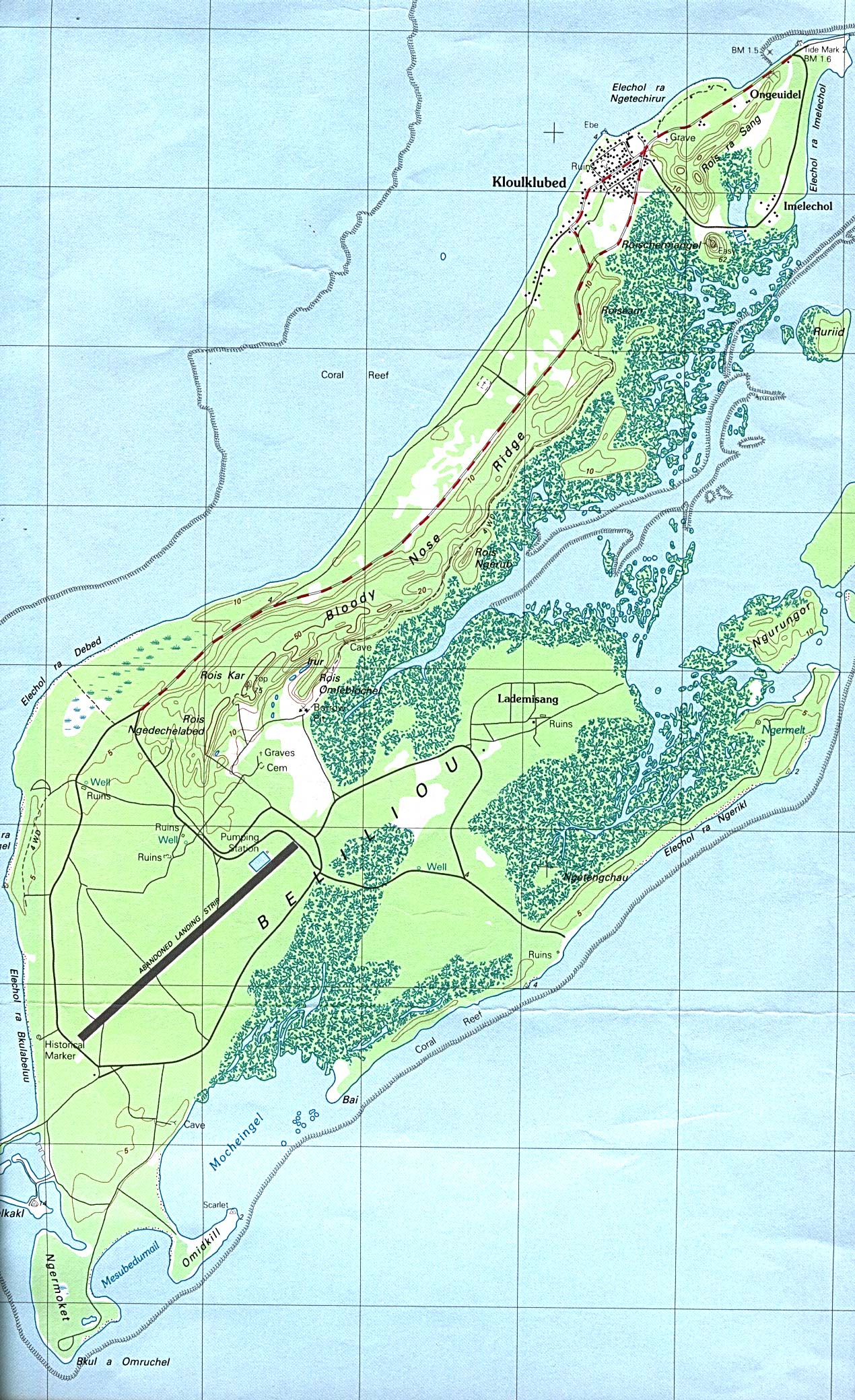
English: Map of Peleliu Island, Palau |
| Datum | |
| Bron | Perry-Castañeda Library Map Collection |
| Auteur | USGS |
Licentie
Deze afbeelding bevindt zich in het publiek domein omdat het materiaal bevat dat oorspronkelijk afkomstig is van de United States Geological Survey, een agentschap van de United States Department of the Interior. Voor meer informatie, zie het officiële USGS-auteursrechtenbeleid
|
Oorspronkelijk uploadlogboek
All following user names refer to en.wikipedia.
- 2005-03-07 21:37 Darwinek 850×1392×8 (517270 bytes)
Bestandsgeschiedenis
Klik op een datum/tijd om het bestand te zien zoals het destijds was.
| Datum/tijd | Miniatuur | Afmetingen | Gebruiker | Opmerking | |
|---|---|---|---|---|---|
| huidige versie | 26 feb 2008 11:30 | | 850 × 1.392 (505 kB) | File Upload Bot (Magnus Manske) | {{BotMoveToCommons|en.wikipedia}} {{Information |Description={{en|Map of Peleliu Island from Perry-Castañeda Library Map Collection [http://www.lib.utexas.edu/maps/islands_oceans_poles/palau_beliliou.jpg source]}} |Source=Transferred from [http://en.w |
Bestandsgebruik
Dit bestand wordt op de volgende pagina gebruikt:
Globaal bestandsgebruik
De volgende andere wiki's gebruiken dit bestand:
- Gebruikt op ar.wikipedia.org
- Gebruikt op bcl.wikipedia.org
- Gebruikt op ceb.wikipedia.org
- Gebruikt op de.wikipedia.org
- Gebruikt op de.wikivoyage.org
- Gebruikt op el.wikipedia.org
- Gebruikt op en.wikipedia.org
- Gebruikt op fi.wikipedia.org
- Gebruikt op it.wikipedia.org
- Gebruikt op ja.wikipedia.org
- Gebruikt op ka.wikipedia.org
- Gebruikt op ko.wikipedia.org
- Gebruikt op pl.wikipedia.org
- Gebruikt op pt.wikipedia.org
- Gebruikt op rw.wikipedia.org
- Gebruikt op sl.wikipedia.org
- Gebruikt op uk.wikipedia.org
- Gebruikt op vi.wikipedia.org
- Gebruikt op www.wikidata.org
- Gebruikt op zh.wikipedia.org