
Bestand:Romania local administrative units.png

Grootte van deze voorvertoning: 800 × 513 pixels. Andere resoluties: 320 × 205 pixels | 640 × 411 pixels | 1.024 × 657 pixels | 1.280 × 821 pixels.
Oorspronkelijk bestand (1.280 × 821 pixels, bestandsgrootte: 438 kB, MIME-type: image/png)
| Dit is een bestand van Wikimedia Commons. Onderstaande beschrijving komt van de beschrijving van het bestand daar. |
Beschrijving
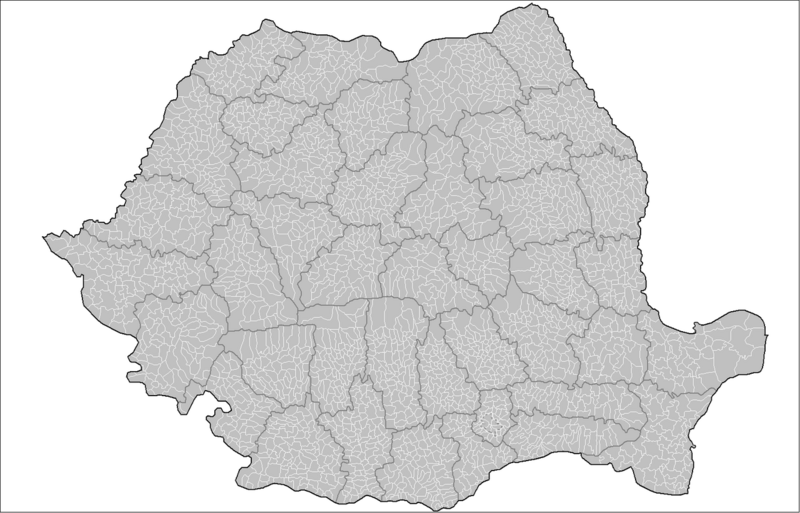
| Beschrijving | Map of the local administrative units (municipalities, cities, and communes) of Romania. Created by Rarelibra 17:37, 1 October 2007 (UTC) for public domain use, using MapInfo Professional v8.5 and various mapping resources. |
| Datum | 1 oktober 2007 (originele uploaddatum) |
| Bron | Geen machineleesbare bron opgegeven. Eigen werk aangenomen (gebaseerd op auteursrechtclaims). |
| Auteur | Geen machineleesbare auteur aanwezig. Op basis van auteursrechtclaims wordt auteur Rarelibra aangenomen. |
Licentie
| Ik, de auteursrechthebbende van dit werk, geef dit werk vrij in het publieke domein. Dit is wereldwijd van toepassing. In sommige landen is dit wettelijk niet mogelijk; in die gevallen geldt: Ik sta iedereen toe dit werk voor eender welk doel te gebruiken, zonder enige voorwaarden, tenzij zulke voorwaarden door de wet worden voorgeschreven. |
Bestandsgeschiedenis
Klik op een datum/tijd om het bestand te zien zoals het destijds was.
| Datum/tijd | Miniatuur | Afmetingen | Gebruiker | Opmerking | |
|---|---|---|---|---|---|
| huidige versie | 11 aug 2014 12:05 | | 1.280 × 821 (438 kB) | Spiridon Ion Cepleanu | Little change on Chilia arm (Danube Delta) : meander |
| 1 okt 2007 19:37 |  | 1.601 × 1.027 (134 kB) | Rarelibra | Map of the local administrative units (municipalities, cities, and communes) of Romania. Created by ~~~~ for public domain use, using MapInfo Professional v8.5 and various mapping resources. |
Bestandsgebruik
Dit bestand wordt op de volgende pagina gebruikt:
Globaal bestandsgebruik
De volgende andere wiki's gebruiken dit bestand:
- Gebruikt op ar.wikipedia.org
- Gebruikt op en.wikipedia.org
- Gebruikt op fr.wikipedia.org
- Gebruikt op hu.wikipedia.org
- Gebruikt op it.wikipedia.org
- Gebruikt op ms.wikipedia.org
- Gebruikt op ro.wikipedia.org
- Gebruikt op sk.wikipedia.org
- Gebruikt op zh.wikipedia.org