
Bestand:Seti districts.png

Grootte van deze voorvertoning: 776 × 600 pixels. Andere resoluties: 311 × 240 pixels | 621 × 480 pixels | 994 × 768 pixels | 1.056 × 816 pixels.
Oorspronkelijk bestand (1.056 × 816 pixels, bestandsgrootte: 27 kB, MIME-type: image/png)
| Dit is een bestand van Wikimedia Commons. Onderstaande beschrijving komt van de beschrijving van het bestand daar. |
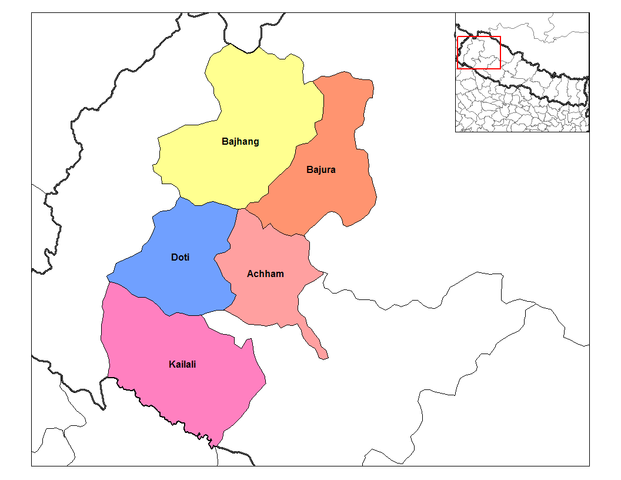
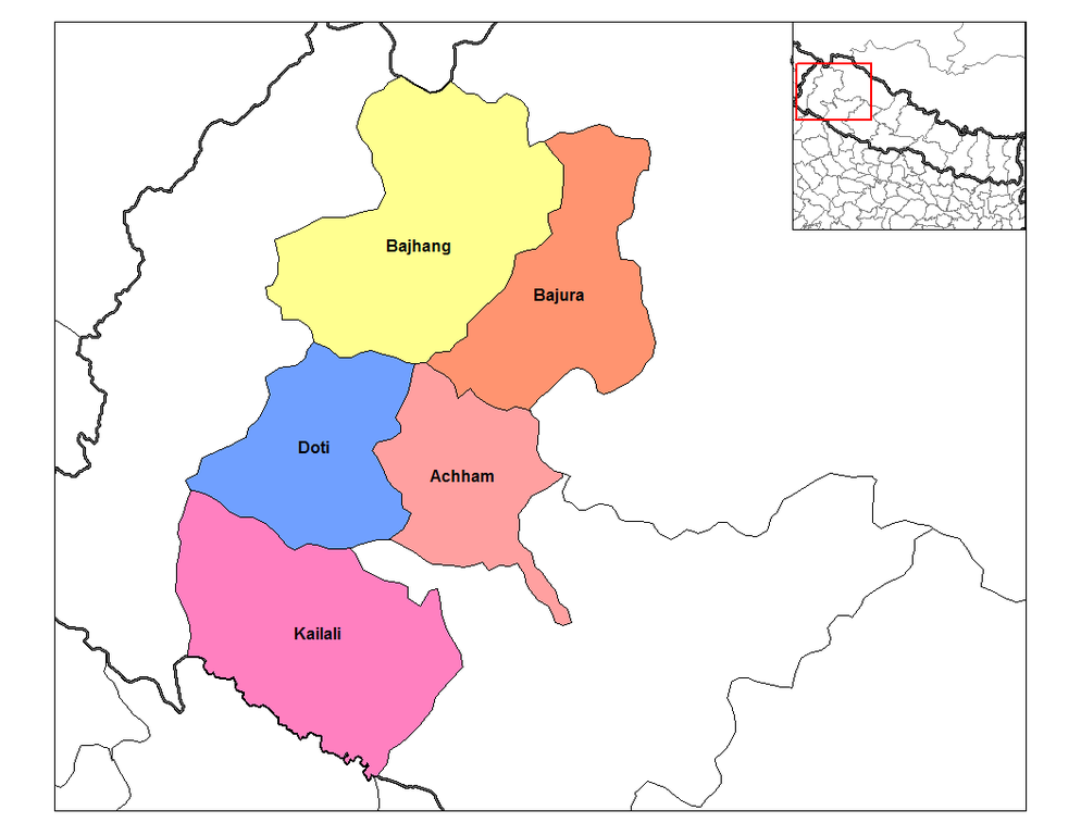
| Beschrijving | Map of the districts of Seti Zone (wp-EN) in Nepal. Created by Rarelibra 19:59, 18 September 2006 (UTC) for public domain use, using MapInfo Professional v8.5 and various mapping resources. | ||
| Datum | 18 september 2006 (originele uploaddatum) | ||
| Bron | Verplaatst vanaf en.wikipedia naar Commons. | ||
| Auteur | De originele uploader was Rarelibra op de Engelstalige Wikipedia | ||
| Toestemming (Hergebruik van dit bestand) |
|
Oorspronkelijk uploadlogboek
De oorspronkelijke beschrijving van deze afbeelding stond hier. Alle volgende gebruikersnamen verwijzen naar en.wikipedia.
- 2006-09-18 19:59 Rarelibra 1056×816×8 (27588 bytes) Map of the districts of Seti zone in Nepal. Created by ~~~~ for public domain use, using MapInfo Professional v8.5 and various mapping resources.
Bestandsgeschiedenis
Klik op een datum/tijd om het bestand te zien zoals het destijds was.
| Datum/tijd | Miniatuur | Afmetingen | Gebruiker | Opmerking | |
|---|---|---|---|---|---|
| huidige versie | 9 apr 2007 20:01 | | 1.056 × 816 (27 kB) | Hégésippe Cormier | {{Information |Description=Map of the districts of '''Seti Zone''' (wp-EN) in Nepal. Created by Rarelibra 19:59, 18 September 2006 (UTC) for public domain use, using MapInfo Professional v8.5 and va |
Bestandsgebruik
Dit bestand wordt op de volgende pagina gebruikt:
Globaal bestandsgebruik
De volgende andere wiki's gebruiken dit bestand:
- Gebruikt op ar.wikipedia.org
- Gebruikt op bg.wikipedia.org
- Gebruikt op bh.wikipedia.org
- Gebruikt op bn.wikipedia.org
- Gebruikt op de.wikipedia.org
- Gebruikt op dty.wikipedia.org
- Gebruikt op el.wikipedia.org
- Gebruikt op en.wikipedia.org
- Gebruikt op es.wikipedia.org
- Gebruikt op fi.wikipedia.org
- Gebruikt op gu.wikipedia.org
- Gebruikt op hif.wikipedia.org
- Gebruikt op it.wikipedia.org
- Gebruikt op ja.wikipedia.org
- Gebruikt op ko.wikipedia.org
- Gebruikt op mai.wikipedia.org
- Gebruikt op ne.wikipedia.org
- Gebruikt op new.wikipedia.org
Globaal gebruik van dit bestand bekijken.