
Bestand:Signal Mountain TX 1900.jpg
Grootte van deze voorvertoning: 800 × 564 pixels. Andere resoluties: 320 × 225 pixels | 640 × 451 pixels | 1.024 × 721 pixels | 1.280 × 902 pixels | 2.000 × 1.409 pixels.
Oorspronkelijk bestand (2.000 × 1.409 pixels, bestandsgrootte: 2,31 MB, MIME-type: image/jpeg)
| Dit is een bestand van Wikimedia Commons. Onderstaande beschrijving komt van de beschrijving van het bestand daar. |
Beschrijving
| Beschrijving |
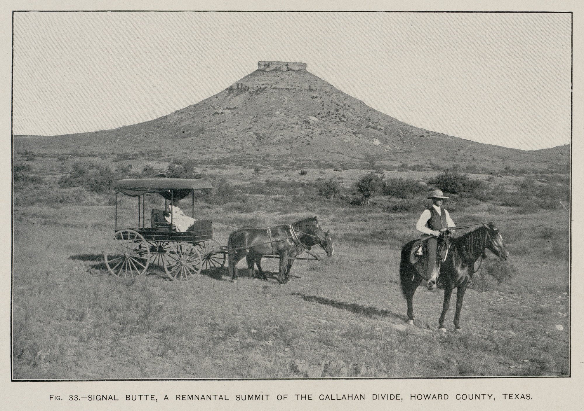
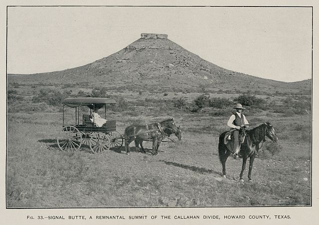
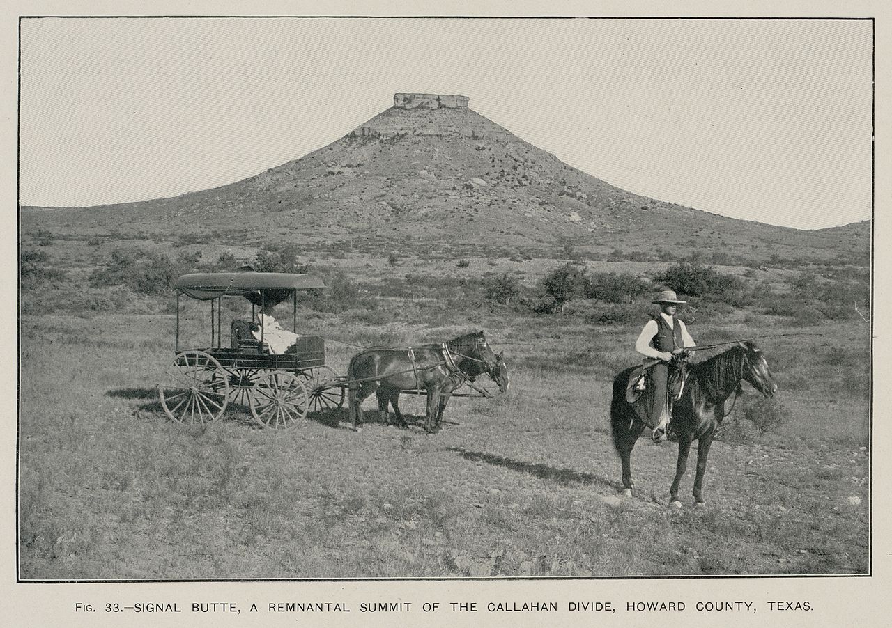
English: Signal Peak near Big Spring, Texas (Texas Geological Survey, 1889) (USGS photo, 1900) |
| Datum | |
| Bron | Hill, R.T. 1900. Topographic atlas of the United States: Physical geography of the Texas region. United States Department of the Interior, U.S. Geological Survey, Folio 3, 12 pp. |
| Auteur | Rogers |
Licentie
Deze afbeelding bevindt zich in het publiek domein omdat het materiaal bevat dat oorspronkelijk afkomstig is van de United States Geological Survey, een agentschap van de United States Department of the Interior. Voor meer informatie, zie het officiële USGS-auteursrechtenbeleid
|
Bestandsgeschiedenis
Klik op een datum/tijd om het bestand te zien zoals het destijds was.
| Datum/tijd | Miniatuur | Afmetingen | Gebruiker | Opmerking | |
|---|---|---|---|---|---|
| huidige versie | 11 jun 2009 06:44 | | 2.000 × 1.409 (2,31 MB) | Leaflet | {{Information |Description={{en|1=Signal Peak near Big Spring, Texas (Texas Geological Survey, 1889) (USGS photo, 1900)}} |Source=Hill, R.T. 1900. Topographic atlas of the United States: Physical geography of the Texas region. United States Department of |
Bestandsgebruik
Dit bestand wordt op de volgende pagina gebruikt:
Globaal bestandsgebruik
De volgende andere wiki's gebruiken dit bestand:
- Gebruikt op ast.wikipedia.org
- Gebruikt op en.wikipedia.org
- Gebruikt op es.wikipedia.org
- Gebruikt op fa.wikipedia.org
- Gebruikt op gl.wikipedia.org
- Gebruikt op ja.wikipedia.org
- Gebruikt op nn.wikipedia.org
- Gebruikt op ru.wikipedia.org