
Bestand:Strait tiran 83.jpg
Grootte van deze voorvertoning: 472 × 599 pixels. Andere resoluties: 189 × 240 pixels | 378 × 480 pixels | 996 × 1.264 pixels.
Oorspronkelijk bestand (996 × 1.264 pixels, bestandsgrootte: 198 kB, MIME-type: image/jpeg)
| Dit is een bestand van Wikimedia Commons. Onderstaande beschrijving komt van de beschrijving van het bestand daar. |
| Beschrijving |
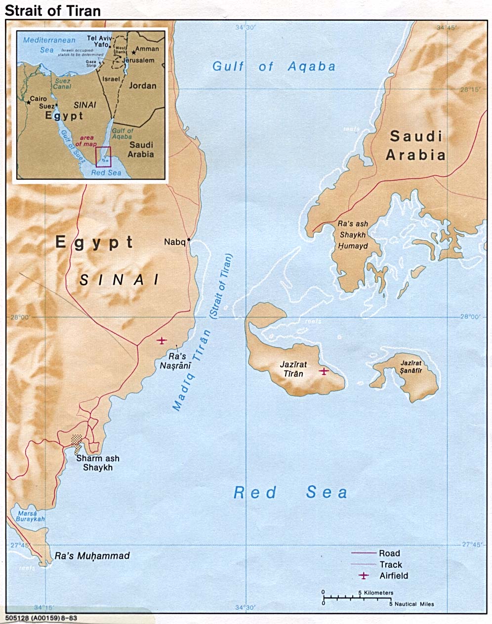
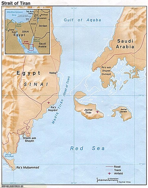
English: Strait of Tiran between Gulf of Aqaba and Red Sea |
|||
| Datum | ||||
| Bron | http://www.lib.utexas.edu/maps/middle_east_and_asia/strait_tiran_83.jpg | |||
| Auteur | "The following maps were produced by the U.S. Central Intelligence Agency, unless otherwise indicated." | |||
| Toestemming (Hergebruik van dit bestand) |
|
|||
| Andere versies | العربيَّة |

Bestandsgeschiedenis
Klik op een datum/tijd om het bestand te zien zoals het destijds was.
| Datum/tijd | Miniatuur | Afmetingen | Gebruiker | Opmerking | |
|---|---|---|---|---|---|
| huidige versie | 23 feb 2007 18:46 | | 996 × 1.264 (198 kB) | Monack | {{Information |Description = {{en|Strait of Tiran between Gulf of Aqaba and Red Sea}} |Source = http://www.lib.utexas.edu/maps/middle_east_and_asia/strait_tiran_83.jpg |Date = 1983 |Author = "The following maps were produced by the U.S. Central Intellige |
Bestandsgebruik
Dit bestand wordt op de volgende 2 pagina's gebruikt:
Globaal bestandsgebruik
De volgende andere wiki's gebruiken dit bestand:
- Gebruikt op af.wikipedia.org
- Gebruikt op als.wikipedia.org
- Gebruikt op ar.wikipedia.org
- Gebruikt op arz.wikipedia.org
- Gebruikt op az.wikipedia.org
- Gebruikt op be.wikipedia.org
- Gebruikt op bg.wikipedia.org
- Gebruikt op bn.wikipedia.org
- Gebruikt op ca.wikipedia.org
- Gebruikt op cs.wikipedia.org
- Gebruikt op da.wikipedia.org
- Gebruikt op de.wikipedia.org
- Gebruikt op el.wikipedia.org
- Gebruikt op en.wikipedia.org
- Gebruikt op en.wikivoyage.org
- Gebruikt op es.wikipedia.org
- Gebruikt op eu.wikipedia.org
- Gebruikt op fa.wikipedia.org
- Gebruikt op fi.wikipedia.org
- Gebruikt op fr.wikipedia.org
- Gebruikt op he.wikipedia.org
- Gebruikt op hy.wikipedia.org
- Gebruikt op id.wikipedia.org
- Gebruikt op it.wikipedia.org
Globaal gebruik van dit bestand bekijken.