
Bestand:USGS Rikers Island.png

Grootte van deze voorvertoning: 732 × 599 pixels. Andere resoluties: 293 × 240 pixels | 586 × 480 pixels | 938 × 768 pixels | 1.250 × 1.024 pixels | 2.501 × 2.048 pixels | 3.287 × 2.692 pixels.
Oorspronkelijk bestand (3.287 × 2.692 pixels, bestandsgrootte: 12,55 MB, MIME-type: image/png)
| Dit is een bestand van Wikimedia Commons. Onderstaande beschrijving komt van de beschrijving van het bestand daar. |
Beschrijving
| Beschrijving | |
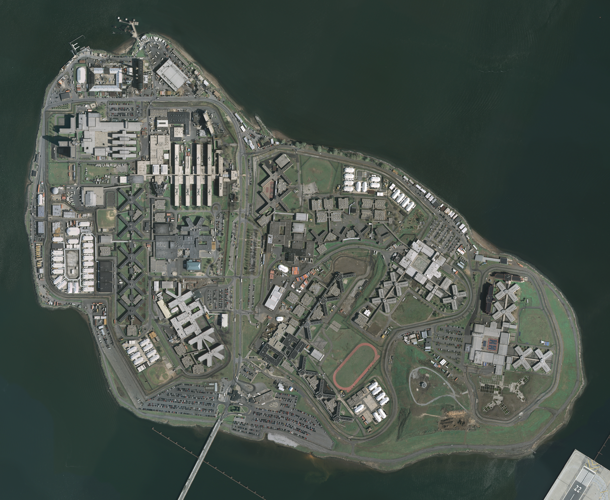
| Datum | Acquired in march 2006; published by USGS in 2008; converted and uploaded to Commons on April 22, 2009. |
| Bron |
The National Map Seamless Server, layer New York City (Mar 2006), latitude 40.79930093 to 40.78455349, longitude -73.89361276 to -73.86990631. Converted from GeoTIFF to PNG using GIMP. |
| Auteur | U.S. Geological Survey, conversion to PNG by uploader (Herr Satz). |
Licentie
Deze afbeelding bevindt zich in het publiek domein omdat het materiaal bevat dat oorspronkelijk afkomstig is van de United States Geological Survey, een agentschap van de United States Department of the Interior. Voor meer informatie, zie het officiële USGS-auteursrechtenbeleid
|
Bestandsgeschiedenis
Klik op een datum/tijd om het bestand te zien zoals het destijds was.
| Datum/tijd | Miniatuur | Afmetingen | Gebruiker | Opmerking | |
|---|---|---|---|---|---|
| huidige versie | 22 apr 2009 14:19 | | 3.287 × 2.692 (12,55 MB) | Herr Satz | {{Information |Description={{en|1=w:Orthophoto of w:Rikers Island.}} |Source=[http://gisdata.usgs.net/website/seamless/viewer.htm ''The National Map'' Seamless Server], layer [http://gisdata.usgs.gov/edc_catalog/fetch_layer_docs.php?LayerName=Ne |
Bestandsgebruik
Dit bestand wordt op de volgende pagina gebruikt:
Globaal bestandsgebruik
De volgende andere wiki's gebruiken dit bestand:
- Gebruikt op ar.wikipedia.org
- Gebruikt op da.wikipedia.org
- Gebruikt op de.wikipedia.org
- Gebruikt op en.wikipedia.org
- Gebruikt op es.wikipedia.org
- Gebruikt op et.wikipedia.org
- Gebruikt op fr.wikipedia.org
- Gebruikt op hy.wikipedia.org
- Gebruikt op ja.wikipedia.org
- Gebruikt op ko.wikipedia.org
- Gebruikt op lt.wikipedia.org
- Gebruikt op ru.wikipedia.org
- Gebruikt op sr.wikipedia.org
- Gebruikt op uk.wikipedia.org