
Bestand:Zambezi river basin-fr.svg

Afmetingen van deze voorvertoning van het type PNG van dit SVG-bestand: 800 × 511 pixels Andere resoluties: 320 × 204 pixels | 640 × 409 pixels | 1.024 × 654 pixels | 1.280 × 818 pixels | 2.560 × 1.636 pixels | 2.931 × 1.873 pixels.
Oorspronkelijk bestand (SVG-bestand, nominaal 2.931 × 1.873 pixels, bestandsgrootte: 2,12 MB)
| Dit is een bestand van Wikimedia Commons. Onderstaande beschrijving komt van de beschrijving van het bestand daar. |
Beschrijving
| Beschrijving | |||
| Datum | |||
| Bron |
Eigen werk (Originele tekst: Own work ; Topographic background map : NASA Shuttle Radar Topography Mission (SRTM30 v.2) (public domain) edited with MicroDEM and dlgv32 Pro / Global Mapper ; UTM projection ; WGS84 datum ; References for the additional data : Demis World Map data (see the approval e-mail and the Demis forum) and UNESCO map ; Locator map : File:Africa map blank.svg (modified) created by myself.) |
||
| Auteur | Eric Gaba (Sting - fr:Sting) | ||
| Toestemming (Hergebruik van dit bestand) |
|
||
| Andere versies |
Afgeleide werken van dit bestand: |
||
| SVG ontwikkeling |

Licentie
I, Sting, de auteursrechthebbende van dit werk, maakt het hierbij onder de volgende licenties beschikbaar:

|
Toestemming wordt verleend voor het kopiëren, verspreiden en/of wijzigen van dit document onder de voorwaarden van de GNU-licentie voor vrije documentatie, versie 1.2 of enige latere versie als gepubliceerd door de Free Software Foundation; zonder Invariant Sections, zonder Front-Cover Texts, en zonder Back-Cover Texts. Een kopie van de licentie is opgenomen in de sectie GNU-licentie voor vrije documentatie. |
| Dit bestand is gelicenseerd onder de Creative Commons-licentie Naamsvermelding-Gelijk delen 3.0 Unported | ||
| Naamsvermelding: I, Sting | ||
| ||
| Deze licentietag is toegevoegd aan dit bestand in verband met de GFDL licentie-update. |
Dit bestand is gelicenseerd onder de Creative Commons-licenties Naamsvermelding-Gelijk delen 2.5 Algemeen, 2.0 Algemeen en 1.0 Algemeen.
Naamsvermelding: I, Sting
- De gebruiker mag:
- Delen – het werk kopiëren, verspreiden en doorgeven
- Remixen – afgeleide werken maken
- Onder de volgende voorwaarden:
- naamsvermelding – U moet op een gepaste manier aan naamsvermelding doen, een link naar de licentie geven, en aangeven of er wijzigingen in het werk zijn aangebracht. U mag dit op elke redelijke manier doen, maar niet zodanig dat de indruk wordt gewekt dat de licentiegever instemt met uw werk of uw gebruik van zijn werk.
- Gelijk delen – Als u het werk heeft geremixt, veranderd, of erop heeft voortgebouwd, moet u het gewijzigde materiaal verspreiden onder dezelfde licentie als het oorspronkelijke werk, of een daarmee compatibele licentie.
U mag zelf één van de licenties kiezen.
Bestandsgeschiedenis
Klik op een datum/tijd om het bestand te zien zoals het destijds was.
| Datum/tijd | Miniatuur | Afmetingen | Gebruiker | Opmerking | |
|---|---|---|---|---|---|
| huidige versie | 19 jan 2008 21:09 | | 2.931 × 1.873 (2,12 MB) | Sting | Trying other solution (part 2) |
| 19 jan 2008 21:03 |  | 2.440 × 1.560 (832 kB) | Sting | Trying other solution (part 1) | |
| 31 jul 2007 15:04 |  | 2.931 × 1.873 (2,12 MB) | Sting | Again... | |
| 31 jul 2007 14:53 |  | 2.931 × 1.873 (2,3 MB) | Sting | Again | |
| 31 jul 2007 14:46 |  | 2.931 × 1.873 (2,31 MB) | Sting | Again | |
| 31 jul 2007 14:35 |  | 2.931 × 1.873 (2,31 MB) | Sting | Again | |
| 31 jul 2007 14:16 |  | 2.931 × 1.873 (2,31 MB) | Sting | Display problem with the raster background map | |
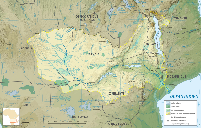
| 31 jul 2007 04:30 |  | 2.931 × 1.873 (2,28 MB) | Sting | {{Information |Description=Map in French of the Zambezi river hydrographic basin, Africa |Source=Own work ;<br/>Topographic background map : [http://www2.jpl.nasa.gov/srtm NASA Shuttle Radar Topography Mission] (SRTM30 v.2) (public domain) edited with [ht |
Bestandsgebruik
Geen enkele pagina gebruikt dit bestand.
Globaal bestandsgebruik
De volgende andere wiki's gebruiken dit bestand:
- Gebruikt op ar.wikipedia.org
- Gebruikt op es.wikipedia.org
- Gebruikt op eu.wikipedia.org
- Gebruikt op fr.wikipedia.org
- Gebruikt op gl.wikipedia.org
- Gebruikt op ky.wikipedia.org
- Gebruikt op ln.wikipedia.org
- Gebruikt op uk.wikipedia.org