
Bestand:Berkshire UK location map.svg

Afmetingen van deze voorvertoning van het type PNG van dit SVG-bestand: 800 × 416 pixels Andere resoluties: 320 × 166 pixels | 640 × 333 pixels | 1.024 × 532 pixels | 1.280 × 666 pixels | 2.560 × 1.331 pixels | 1.425 × 741 pixels.
Oorspronkelijk bestand (SVG-bestand, nominaal 1.425 × 741 pixels, bestandsgrootte: 1,51 MB)
| Dit is een bestand van Wikimedia Commons. Onderstaande beschrijving komt van de beschrijving van het bestand daar. |
| Beschrijving |
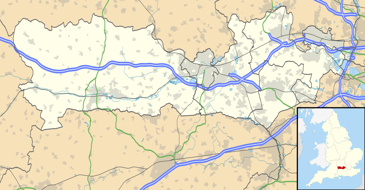
Map of Berkshire, UK with the following information shown:
Equirectangular map projection on WGS 84 datum, with N/S stretched 160% Geographic limits:
|
| Datum | |
| Bron |
|
| Auteur | Nilfanion, created using Ordnance Survey data |
| Toestemming (Hergebruik van dit bestand) |
Dit bestand is gelicenseerd onder de Creative Commons-licentie Naamsvermelding-Gelijk delen 3.0 Unported Naamsvermelding: Contains Ordnance Survey data © Crown copyright and database right
|
| Andere versies | File:Berkshire UK district map (blank).svg - Blank map |
.svg)
Bestandsgeschiedenis
Klik op een datum/tijd om het bestand te zien zoals het destijds was.
| Datum/tijd | Miniatuur | Afmetingen | Gebruiker | Opmerking | |
|---|---|---|---|---|---|
| huidige versie | 26 sep 2010 19:56 | | 1.425 × 741 (1,51 MB) | Nilfanion | {{Information |Description=Map of Berkshire, UK with the following information shown: *Administrative borders *Coastline, lakes and rivers *Roads and railways *Urban areas Equirectangular map projection on WGS 84 datum, with N/S stretched |
Bestandsgebruik
Meer dan 100 pagina's gebruiken dit bestand. De volgende lijst geeft alleen de eerste 100 pagina's weer die dit bestand gebruiken. Er is ook een volledige lijst beschikbaar.
- Aldermaston
- Aldworth
- Arborfield (Verenigd Koninkrijk)
- Ascot (Berkshire)
- Ashampstead
- Barkham
- Basildon (Berkshire)
- Beech Hill
- Beedon
- Beenham (plaats)
- Binfield
- Bisham
- Boxford (Berkshire)
- Bracknell
- Bradfield (Berkshire)
- Bray (Verenigd Koninkrijk)
- Brightwalton
- Brimpton
- Britwell
- Bucklebury (Verenigd Koninkrijk)
- Burghfield
- Catmore
- Caversham
- Chaddleworth
- Chalvey
- Chieveley
- Cippenham
- Clewer
- Cold Ash
- Colnbrook
- Colnbrook with Poyle
- Combe (Berkshire)
- Compton (Berkshire)
- Cookham
- Crowthorne
- Datchet
- Ditton (Berkshire)
- Earley
- East Garston
- East Ilsley
- Enborne
- Englefield
- Eton (Berkshire)
- Eton Wick
- Farnborough (Berkshire)
- Fawley (Berkshire)
- Finchampstead
- Great Shefford
- Hampstead Norreys
- Hermitage (Berkshire)
- Holybrook
- Holyport
- Hungerford (Berkshire)
- Hurley (Berkshire)
- Hurst (Wokingham)
- Inkpen
- Kintbury
- Lambourn
- Langley (Slough)
- Maidenhead
- Midgham
- Mortimer Common
- Newbury
- Old Windsor
- Pangbourne
- Poyle
- Purley on Thames
- Remenham
- Sandhurst (Engeland)
- Shinfield
- Slough
- Sonning
- Stanford Dingley
- Streatley (Berkshire)
- Sulham
- Sulhamstead
- Sunningdale
- Swallowfield
- Thatcham
- Theale
- Tidmarsh
- Tidmarsh with Sulham
- Tilehurst
- Twyford (Berkshire)
- Ufton Nervet
- Upton (Slough)
- Waltham St. Lawrence
- Warfield (Engeland)
- Wargrave
- Welford (Berkshire)
- White Waltham
- Windsor (Verenigd Koninkrijk)
- Winkfield
- Winnersh
- Winterbourne (Berkshire)
- Wokefield
- Wokingham (stad)
- Woodley (Engeland)
- Woolhampton
- Wraysbury
Meer koppelingen naar dit bestand bekijken.
Globaal bestandsgebruik
De volgende andere wiki's gebruiken dit bestand:
- Gebruikt op ar.wikipedia.org
- Gebruikt op azb.wikipedia.org
- Gebruikt op bg.wikipedia.org
- Gebruikt op bn.wikipedia.org
- Gebruikt op ceb.wikipedia.org
- Gebruikt op en.wikipedia.org
- Slough
- Newbury, Berkshire
- Britwell
- Chalvey
- Colnbrook
- Langley, Berkshire
- Upton, Slough
- Speen, Berkshire
- Maidenhead
- Sandhurst, Berkshire
- Bracknell
- Wraysbury
- Datchet
- Hungerford
- Windsor, Berkshire
- Caversham, Reading
- Frogmore
- Eton, Berkshire
- Ditton, Slough
- Horton, Berkshire
- Sunningdale
- Earley
- Hurley, Berkshire
Globaal gebruik van dit bestand bekijken.