
Bestand:Charleroi 1933.jpg
Oorspronkelijk bestand (6.835 × 4.668 pixels, bestandsgrootte: 9,22 MB, MIME-type: image/jpeg)
| Dit is een bestand van Wikimedia Commons. Onderstaande beschrijving komt van de beschrijving van het bestand daar. |
Beschrijving
| Beschrijving |
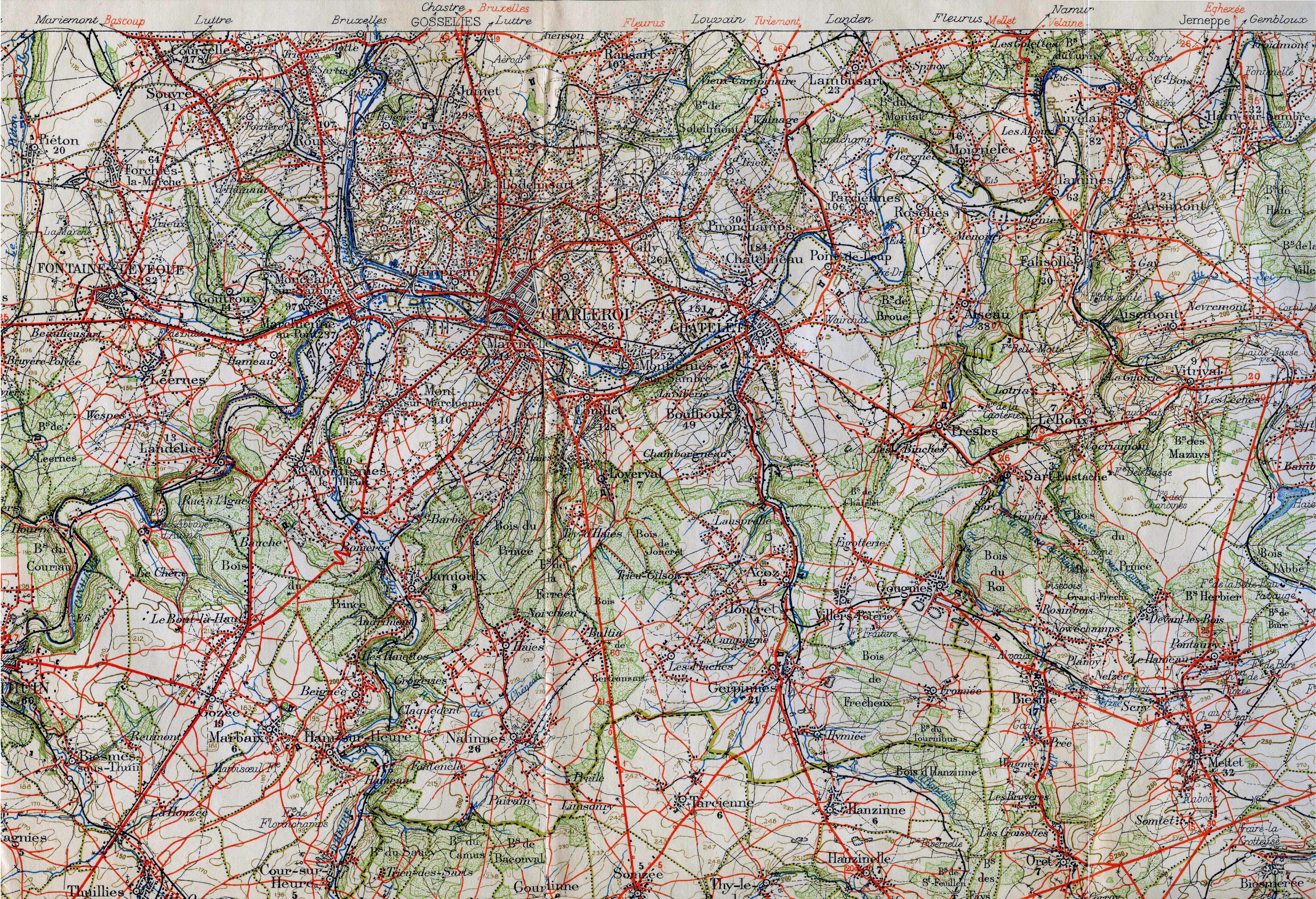
English: Militairy staff map in the area around Charleroi in 1933. It shows the vicinal lines and many railways. This military staff map was cut up and pasted on a canvas.
Railway lines are black lines with marks on one side. Smalltrack is a thinner line. If there are marks on both sides it is double track. After 1933 more vicinal lines where build. Nederlands: Staff kaart rond Charleroi die meerdere buurtspoorweglijnen laat zien, alsmede spoorlijnen. Er komen na 1933 nog meer buurtspoorlijnen. |
| Datum | (scanned 2010) |
| Bron | Belgian militairy staf map (VII. Mons) |
| Auteur | L'Institut Cartographique Militaire (Belgian army) |
| Dit is een geretoucheerde foto, wat betekent dat de originele versie digitaal aangepast is. Aanpassingen: removed canvas and joined the three parts, cropped. Het origineel kan hier bekeken worden: Charleroi 1933.orig.jpg. Aanpassingen gedaan door "smiley.toerist".
|
Licentie
|
Dit werk bevindt zich in het publiek domein in landen en gebieden waar de auteursrechttermijn het leven van de auteur plus 70 jaar of minder is.
| |
| Van dit bestand is vastgesteld dat er geen bekende auteursrechtaanspraken op rusten, alle aanverwante en naburige rechten daarbij inbegrepen. | |
Bestandsgeschiedenis
Klik op een datum/tijd om het bestand te zien zoals het destijds was.
| Datum/tijd | Miniatuur | Afmetingen | Gebruiker | Opmerking | |
|---|---|---|---|---|---|
| huidige versie | 30 aug 2010 17:10 | | 6.835 × 4.668 (9,22 MB) | Smiley.toerist | {{Information |Description={{en|1=Militairy staff map in the area around Charleroi in 1933. It shows the vicinal lines and many railways. This military staff map was cut up and pasted on a canvas. <br> Railway lines are black lines with marks on one side |
Bestandsgebruik
Dit bestand wordt op de volgende pagina gebruikt: