
Bestand:King-George-Island-location-map.png
Grootte van deze voorvertoning: 800 × 548 pixels. Andere resoluties: 320 × 219 pixels | 640 × 439 pixels | 1.024 × 702 pixels | 1.280 × 877 pixels | 1.669 × 1.144 pixels.
Oorspronkelijk bestand (1.669 × 1.144 pixels, bestandsgrootte: 150 kB, MIME-type: image/png)
| Dit is een bestand van Wikimedia Commons. Onderstaande beschrijving komt van de beschrijving van het bestand daar. |
Beschrijving
| Beschrijving |
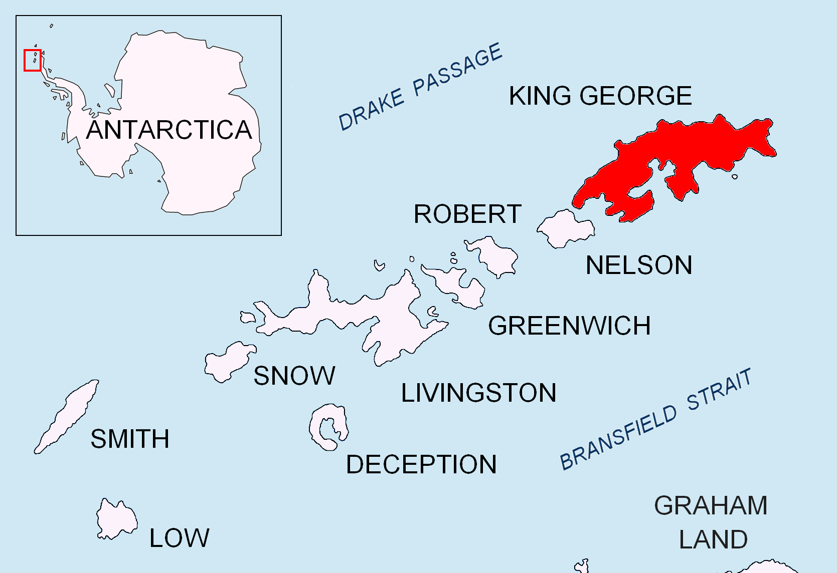
English: Location map of King George Island in the South Shetland Islands. |
| Datum | |
| Bron | Eigen werk |
| Auteur | Apcbg |
Licentie
Ik, de auteursrechthebbende van dit werk, maak het hierbij onder de volgende licenties beschikbaar:
Dit bestand is gelicenseerd onder de Creative Commons-licentie Naamsvermelding-Gelijk delen 3.0 Unported
- De gebruiker mag:
- Delen – het werk kopiëren, verspreiden en doorgeven
- Remixen – afgeleide werken maken
- Onder de volgende voorwaarden:
- naamsvermelding – U moet op een gepaste manier aan naamsvermelding doen, een link naar de licentie geven, en aangeven of er wijzigingen in het werk zijn aangebracht. U mag dit op elke redelijke manier doen, maar niet zodanig dat de indruk wordt gewekt dat de licentiegever instemt met uw werk of uw gebruik van zijn werk.
- Gelijk delen – Als u het werk heeft geremixt, veranderd, of erop heeft voortgebouwd, moet u het gewijzigde materiaal verspreiden onder dezelfde licentie als het oorspronkelijke werk, of een daarmee compatibele licentie.

|
Toestemming wordt verleend voor het kopiëren, verspreiden en/of wijzigen van dit document onder de voorwaarden van de GNU-licentie voor vrije documentatie, versie 1.2 of enige latere versie als gepubliceerd door de Free Software Foundation; zonder Invariant Sections, zonder Front-Cover Texts, en zonder Back-Cover Texts. Een kopie van de licentie is opgenomen in de sectie GNU-licentie voor vrije documentatie. |
U mag zelf één van de licenties kiezen.
Bestandsgeschiedenis
Klik op een datum/tijd om het bestand te zien zoals het destijds was.
| Datum/tijd | Miniatuur | Afmetingen | Gebruiker | Opmerking | |
|---|---|---|---|---|---|
| huidige versie | 24 aug 2010 19:27 | | 1.669 × 1.144 (150 kB) | Apcbg | + location in Antarctica |
| 27 apr 2010 20:57 |  | 1.669 × 1.144 (5,47 MB) | Apcbg | {{Information |Description={{en|1=Location map of King George Island in the South Shetland Islands.}} |Source={{own}} |Author=Apcbg |Date=2010-04-27 |Permission= |other_versions= }} Category:Maps of Antarctica |
Bestandsgebruik
Dit bestand wordt op de volgende 2 pagina's gebruikt:
Globaal bestandsgebruik
De volgende andere wiki's gebruiken dit bestand:
- Gebruikt op ar.wikipedia.org
- Gebruikt op az.wikipedia.org
- Gebruikt op bg.wikipedia.org
- Gebruikt op en.wikipedia.org
- Henryk Arctowski Polish Antarctic Station
- Bellingshausen Station
- Artigas Base
- Shearer Stack
- Sherratt Bay
- Syrezol Rocks
- Chabrier Rock
- Telefon Rocks
- Simpson Rocks
- Caraquet Rock
- Upton Rock
- Ørnen Rocks
- Nancy Rock
- Napier Rock
- Growler Rock
- Tu Rocks
- Dufayel Island
- Emm Rock
- Low Rock
- Livonia Rock
- Hauken Rock
- Martello Tower (South Shetland Islands)
- Twin Pinnacles
- Sinbad Rock
- Hole Rock
- Vauréal Peak
- Limit Rock
- Gebruikt op es.wikipedia.org
- Gebruikt op fi.wikipedia.org
- Gebruikt op ko.wikipedia.org
- Gebruikt op mk.wikipedia.org
- Gebruikt op nn.wikipedia.org
- Gebruikt op pt.wikipedia.org
- Gebruikt op ta.wikipedia.org
- Gebruikt op zh.wikipedia.org
Globaal gebruik van dit bestand bekijken.