
Bestand:Map of Mpumalanga with Emalahleni highlighted (2016).svg

Afmetingen van deze voorvertoning van het type PNG van dit SVG-bestand: 617 × 599 pixels Andere resoluties: 247 × 240 pixels | 494 × 480 pixels | 791 × 768 pixels | 1.054 × 1.024 pixels | 2.108 × 2.048 pixels | 768 × 746 pixels.
Oorspronkelijk bestand (SVG-bestand, nominaal 768 × 746 pixels, bestandsgrootte: 345 kB)
| Dit is een bestand van Wikimedia Commons. Onderstaande beschrijving komt van de beschrijving van het bestand daar. |
.svg)
Beschrijving
| Beschrijving |
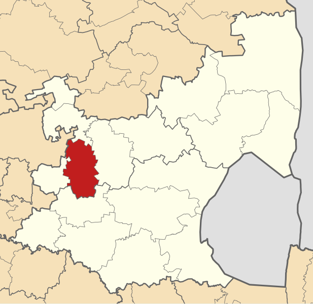
English: Map of municipal boundaries in Mpumalanga, as they are after the municipal elections of 3 August 2016, with the Emalahleni Local Municipality highlighted in red. Based on File:Map of Mpumalanga with municipalities blank (2016).svg. |
| Datum | |
| Bron | Eigen werk |
| Auteur | Htonl |
.svg)
Licentie
Ik, de auteursrechthebbende van dit werk, maak het hierbij onder de volgende licenties beschikbaar:

|
Toestemming wordt verleend voor het kopiëren, verspreiden en/of wijzigen van dit document onder de voorwaarden van de GNU-licentie voor vrije documentatie, versie 1.2 of enige latere versie als gepubliceerd door de Free Software Foundation; zonder Invariant Sections, zonder Front-Cover Texts, en zonder Back-Cover Texts. Een kopie van de licentie is opgenomen in de sectie GNU-licentie voor vrije documentatie. |
This file is licensed under the Creative Commons Attribution-Share Alike Attribution-Share Alike 4.0 International, 3.0 Unported, 2.5 Generic, 2.0 Generic and 1.0 Generic license.
- De gebruiker mag:
- Delen – het werk kopiëren, verspreiden en doorgeven
- Remixen – afgeleide werken maken
- Onder de volgende voorwaarden:
- naamsvermelding – U moet op een gepaste manier aan naamsvermelding doen, een link naar de licentie geven, en aangeven of er wijzigingen in het werk zijn aangebracht. U mag dit op elke redelijke manier doen, maar niet zodanig dat de indruk wordt gewekt dat de licentiegever instemt met uw werk of uw gebruik van zijn werk.
- Gelijk delen – Als u het werk heeft geremixt, veranderd, of erop heeft voortgebouwd, moet u het gewijzigde materiaal verspreiden onder dezelfde licentie als het oorspronkelijke werk, of een daarmee compatibele licentie.
U mag zelf één van de licenties kiezen.
Bestandsgeschiedenis
Klik op een datum/tijd om het bestand te zien zoals het destijds was.
| Datum/tijd | Miniatuur | Afmetingen | Gebruiker | Opmerking | |
|---|---|---|---|---|---|
| huidige versie | 11 sep 2016 01:55 | | 768 × 746 (345 kB) | Htonl | == {{int:filedesc}} == {{Information |Description ={{en|1=Map of municipal boundaries in w:Mpumalanga, as they are after the municipal elections of 3 August 2016, with the [[w:Emalahleni Local Munici... |
Bestandsgebruik
Dit bestand wordt op de volgende pagina gebruikt:
Globaal bestandsgebruik
De volgende andere wiki's gebruiken dit bestand:
- Gebruikt op af.wikipedia.org
- Gebruikt op de.wikipedia.org
- Gebruikt op en.wikipedia.org
- Gebruikt op ha.wikipedia.org
- Gebruikt op ig.wikipedia.org
- Gebruikt op it.wikipedia.org
- Gebruikt op nso.wikipedia.org
- Gebruikt op ru.wikipedia.org
- Gebruikt op sw.wikipedia.org
- Gebruikt op ts.wikipedia.org
- Gebruikt op www.wikidata.org
- Gebruikt op yo.wikipedia.org
- Gebruikt op zu.wikipedia.org
.svg)