
Bestand:Soo Locks and International Bridge USACE 2010-04-19.jpg

Grootte van deze voorvertoning: 800 × 532 pixels. Andere resoluties: 320 × 213 pixels | 640 × 426 pixels | 1.024 × 681 pixels | 1.280 × 852 pixels | 2.560 × 1.703 pixels | 6.144 × 4.088 pixels.
Oorspronkelijk bestand (6.144 × 4.088 pixels, bestandsgrootte: 9,29 MB, MIME-type: image/jpeg)
| Dit is een bestand van Wikimedia Commons. Onderstaande beschrijving komt van de beschrijving van het bestand daar. |
| Beschrijving |
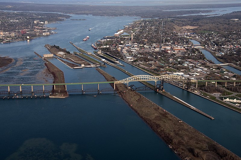
English: The Soo Locks and the Sault Ste. Marie International Bridge over the St. Marys River between Sault Ste. Marie, Ontario and Sault Ste. Marie, Michigan. View is looking east. |
|||
| Datum | ||||
| Bron | US Army Corps of Engineers Digital Visual Library (DVL) [1]. Photo ID: 100419-A-9999M-849 | |||
| Auteur | US Army Corps of Engineers, Richard McDonald | |||
| Toestemming (Hergebruik van dit bestand) |
|
| Objectlocatie | | Deze en andere afbeeldingen in: OpenStreetMap |
|---|
| Aantekeningen | Deze afbeelding is aangetekend: Bekijk de aantekeningen op Commons |
Bestandsgeschiedenis
Klik op een datum/tijd om het bestand te zien zoals het destijds was.
| Datum/tijd | Miniatuur | Afmetingen | Gebruiker | Opmerking | |
|---|---|---|---|---|---|
| huidige versie | 3 sep 2011 23:49 | | 6.144 × 4.088 (9,29 MB) | Life of Riley | {{Information |Description={{en|The Soo Locks and the Sault Ste. Marie International Bridge over the St. Marys River between Sault Ste. Marie, Ontario and Sault Ste. Marie, Michigan. View is look |
Bestandsgebruik
Dit bestand wordt op de volgende pagina gebruikt:
Globaal bestandsgebruik
De volgende andere wiki's gebruiken dit bestand:
- Gebruikt op en.wikipedia.org