
Bestand:Vandalia and the Dayton Airport.jpg
Grootte van deze voorvertoning: 800 × 600 pixels. Andere resoluties: 320 × 240 pixels | 640 × 480 pixels | 1.024 × 768 pixels | 1.280 × 960 pixels | 2.272 × 1.704 pixels.
Oorspronkelijk bestand (2.272 × 1.704 pixels, bestandsgrootte: 1,83 MB, MIME-type: image/jpeg)
| Dit is een bestand van Wikimedia Commons. Onderstaande beschrijving komt van de beschrijving van het bestand daar. |
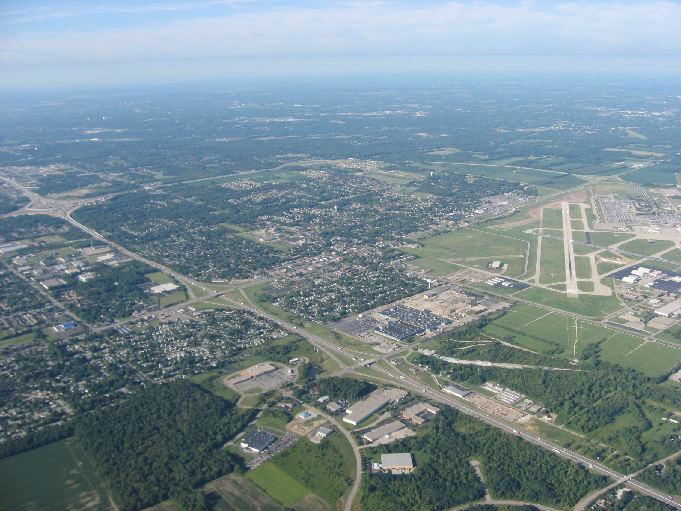
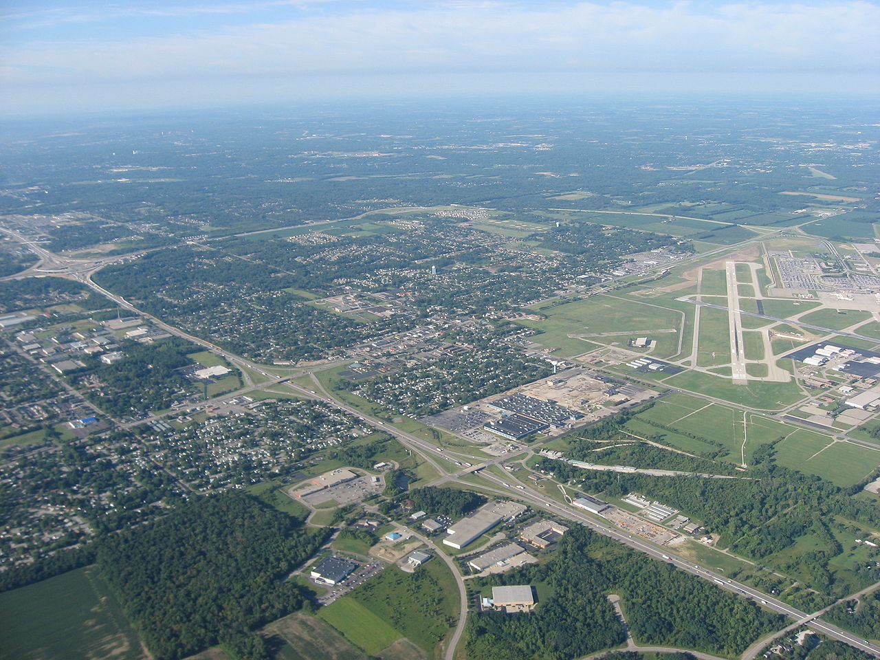
| Beschrijving | Aerial view of Vandalia, a city in Montgomery County, Ohio, United States, with the Dayton International Airport visible to the right. Interstate 75 is visible as the major highway in the middle of the picture. Picture taken from a Diamond Eclipse light airplane at an altitude of 4,490 feet MSL and a bearing of approximately 235º. | ||
| Datum | Genomen op 12 augustus 2008 | ||
| Bron | Eigen werk | ||
| Auteur | Nyttend | ||
| Toestemming (Hergebruik van dit bestand) |
|
Bestandsgeschiedenis
Klik op een datum/tijd om het bestand te zien zoals het destijds was.
| Datum/tijd | Miniatuur | Afmetingen | Gebruiker | Opmerking | |
|---|---|---|---|---|---|
| huidige versie | 22 sep 2008 15:22 | | 2.272 × 1.704 (1,83 MB) | Nyttend | {{Information |Description=Aerial view of {{w|Vandalia, Ohio|Vandalia}}, a city in {{w|Montgomery County, Ohio|Montgomery County}}, {{w|Ohio}}, {{w|United States}}, with the {{w|Dayton International Airport}} visible to the right. {{w|Interstate 75}} is |
Bestandsgebruik
Dit bestand wordt op de volgende pagina gebruikt:
Globaal bestandsgebruik
De volgende andere wiki's gebruiken dit bestand:
- Gebruikt op ar.wikipedia.org
- Gebruikt op arz.wikipedia.org
- Gebruikt op azb.wikipedia.org
- Gebruikt op ca.wikipedia.org
- Gebruikt op ceb.wikipedia.org
- Gebruikt op ce.wikipedia.org
- Gebruikt op cy.wikipedia.org
- Gebruikt op de.wikipedia.org
- Gebruikt op en.wikipedia.org
- Gebruikt op es.wikipedia.org
- Gebruikt op eu.wikipedia.org
- Gebruikt op fa.wikipedia.org
- Gebruikt op fr.wikipedia.org
- Gebruikt op ht.wikipedia.org
- Gebruikt op it.wikipedia.org
- Gebruikt op lld.wikipedia.org
- Gebruikt op pl.wikipedia.org
- Gebruikt op pt.wikipedia.org
- Gebruikt op sh.wikipedia.org
- Gebruikt op simple.wikipedia.org
- Gebruikt op sr.wikipedia.org
- Gebruikt op tr.wikipedia.org
- Gebruikt op tt.wikipedia.org
- Gebruikt op uk.wikipedia.org
- Gebruikt op ur.wikipedia.org
- Gebruikt op uz.wikipedia.org
- Gebruikt op vi.wikipedia.org
- Gebruikt op vo.wikipedia.org
- Gebruikt op www.wikidata.org
- Gebruikt op zh-min-nan.wikipedia.org
- Gebruikt op zh.wikipedia.org