
Ightham
| Civil parish in Engeland | |||
|---|---|---|---|
 | |||
| Situering | |||
| Regio | South East England | ||
| Graafschap | Kent | ||
| District | Tonbridge and Malling | ||
| Coördinaten | 51° 17' NB, 0° 17' OL | ||
| Algemeen | |||
| Oppervlakte | 9,2422 km² | ||
| Inwoners (2011) |
2084 (225 inw./km²) | ||
| Overig | |||
| Postcode(s) | TN15 | ||
| Netnummer(s) | 01732 88 | ||
| Grid code | TQ595565 | ||
| Post town | SEVENOAKS | ||
| ONS-code | E04005099 | ||
| Foto's | |||

| |||
| Ightham | |||
| |||
Ightham is een civil parish in het bestuurlijke gebied Tonbridge and Malling, in het Engelse graafschap Kent.
Geboren[bewerken | brontekst bewerken]
- Anna Lee (1913-2004), actrice
-
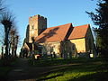 St Peter's Church, Ightham

Geplaatst op:
15-07-2007
15-07-2007
Dit artikel is een beginnetje over landen & volken. U wordt uitgenodigd om op bewerken te klikken om uw kennis aan dit artikel toe te voegen.